Area Overview for CV9 3BX
Photos of CV9 3BX
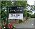
17 photos from this area
Area Information
Key information about the CV9 3BX including its size, population, and administrative classification.
- Area Type
- Postcode
- Area Size
- 1.1 hectares
- Population
- 2238
- Population Density
- 1544 people/km²
House Prices in CV9 3BX
31
Properties
£122,003
Average Sold Price
£55,500
Lowest Price
£211,000
Highest Price
Showing 31 properties
| Address | Type | Beds | Baths | Last Sale Price | Last Sale Date | |
|---|---|---|---|---|---|---|
| 65 Lister Road, Atherstone, CV9 3BX | Terraced | 2 | 1 | £145,000 | Nov 2023 | |
| 64 Lister Road, Atherstone, CV9 3BX | Retail | 3 | 1 | £175,000 | Sep 2022 | |
| 45 Lister Road, Atherstone, CV9 3BX | Semi-detached | 3 | 1 | £211,000 | Feb 2022 | |
| 41 Lister Road, Atherstone, CV9 3BX | Semi-detached | 3 | 1 | £195,000 | Aug 2021 | |
| 66 Lister Road, Atherstone, CV9 3BX | Terraced | 3 | 1 | £160,000 | Mar 2020 | |
| 67 Lister Road, Atherstone, CV9 3BX | Terraced | 2 | 1 | £155,000 | Nov 2019 | |
| 51 Lister Road, Atherstone, CV9 3BX | house | - | - | £105,000 | Aug 2017 | |
| 55 Lister Road, Atherstone, CV9 3BX | Terraced | 2 | 1 | £105,100 | Feb 2016 | |
| 53 Lister Road, Atherstone, CV9 3BX | Terraced | 3 | 1 | £110,000 | Jan 2016 | |
| 79 Lister Road, Atherstone, CV9 3BX | house | 3 | - | £117,500 | Mar 2015 |
Page 1 of 4
Energy Efficiency in CV9 3BX
Amenities
Schools
| Rank | School | Type | Entry gender | Ages |
|---|
Explore more schools in this area
Go to Schools tabDemographics
Household Size
Two person
most common
Accommodation Type
Houses
most common
Tenure
75
majority
Ethnic Group
White
most common
Religion
N/A
most common
Household Composition
N/A
most common
Age
47
median
Adults (30-64 years)
most common
Household Deprivation
N/A
with no deprivation
NS-SEC
35
in Lower managerial occupations
Explore more demographic insights in this area
Go to Demographics tabPlanning
Planning Constraints
- Flood RiskPremium
- Ramsar Wetland SitesPremium
- Area of Outstanding Natural BeautyPremium
- Protected Nature ReservePremium
- Protected WoodlandPremium