Area Overview for CV9 1HP
Photos of CV9 1HP

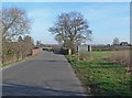
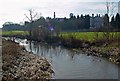
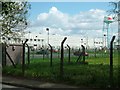
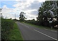


17 photos from this area
Area Information
Key information about the CV9 1HP including its size, population, and administrative classification.
- Area Type
- Postcode
- Area Size
- 3.4 hectares
- Population
- 2238
- Population Density
- 1544 people/km²
House Prices in CV9 1HP
53
Properties
£203,167
Average Sold Price
£59,995
Lowest Price
£360,000
Highest Price
Showing 53 properties
| Address | Type | Beds | Baths | Last Sale Price | Last Sale Date | |
|---|---|---|---|---|---|---|
| 36 Windmill Road, Atherstone, CV9 1HP | Detached | 3 | 1 | £300,000 | Aug 2025 | |
| 53 Windmill Road, Atherstone, CV9 1HP | Detached | 3 | 1 | £282,000 | Nov 2024 | |
| 63 Windmill Road, Atherstone, CV9 1HP | Detached | 3 | 1 | £307,500 | Oct 2024 | |
| 61 Windmill Road, Atherstone, CV9 1HP | Detached | 4 | 2 | £330,000 | Jan 2023 | |
| 37 Windmill Road, Atherstone, CV9 1HP | Detached | 5 | 3 | £360,000 | Aug 2022 | |
| 41 Windmill Road, Atherstone, CV9 1HP | Retail | 3 | 2 | £260,000 | Aug 2022 | |
| 13 Windmill Road, Atherstone, CV9 1HP | Bungalow | 2 | - | £254,000 | Jun 2021 | |
| 29 Windmill Road, Atherstone, CV9 1HP | Detached | 3 | 1 | £241,000 | Dec 2020 | |
| 25 Windmill Road, Atherstone, CV9 1HP | Detached | 4 | 1 | £236,000 | Apr 2020 | |
| 11 Windmill Road, Atherstone, CV9 1HP | Bungalow | - | - | £245,000 | Jul 2019 |
Page 1 of 6
Energy Efficiency in CV9 1HP
Amenities
Schools
| Rank | School | Type | Entry gender | Ages |
|---|
Explore more schools in this area
Go to Schools tabDemographics
Household Size
Two person
most common
Accommodation Type
Houses
most common
Tenure
75
majority
Ethnic Group
White
most common
Religion
N/A
most common
Household Composition
N/A
most common
Age
47
median
Adults (30-64 years)
most common
Household Deprivation
N/A
with no deprivation
NS-SEC
35
in Lower managerial occupations
Explore more demographic insights in this area
Go to Demographics tabPlanning
Planning Constraints
- Flood RiskPremium
- Ramsar Wetland SitesPremium
- Area of Outstanding Natural BeautyPremium
- Protected Nature ReservePremium
- Protected WoodlandPremium