Area Overview for CV8 3HW
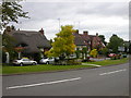
Photos of CV8 3HW

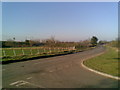

![Brandon Hall Hotel and Spa [1] in CV8 3HW](https://images.propbar.co.uk/images/geograph/61/69/6169197_120.jpg)
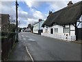
![Brandon buildings [1] in CV8 3HW](https://images.propbar.co.uk/images/geograph/62/71/6271167_120.jpg)
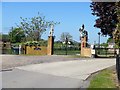
![Brandon buildings [2] in CV8 3HW](https://images.propbar.co.uk/images/geograph/62/71/6271177_120.jpg)


48 photos from this area
Area Information
Key information about the CV8 3HW including its size, population, and administrative classification.
- Area Type
- Postcode
- Area Size
- 22.5 hectares
- Population
- 1724
- Population Density
- 170 people/km²
House Prices in CV8 3HW
49
Properties
£323,413
Average Sold Price
£120,000
Lowest Price
£675,000
Highest Price
Showing 49 properties
| Address | Type | Beds | Baths | Last Sale Price | Last Sale Date | |
|---|---|---|---|---|---|---|
| Fairview, Main Street, Brandon, CV8 3HW | Detached | 4 | 3 | £425,000 | Feb 2025 | |
| Dutton Cottage, Main Street, Brandon, CV8 3HW | Cottage | 2 | 1 | £255,000 | Sep 2023 | |
| Millington House, Main Street, Brandon, CV8 3HW | house | - | - | £675,000 | Jul 2023 | |
| Dundarach, Main Street, Brandon, CV8 3HW | Detached | 4 | 2 | £425,000 | Feb 2022 | |
| Hillside, Main Street, Brandon, CV8 3HW | Semi-detached | 4 | 2 | £510,000 | Jun 2021 | |
| The Gable, Main Street, Brandon, CV8 3HW | Detached | 3 | 1 | £341,250 | Jun 2021 | |
| Fourways, Main Street, Brandon, CV8 3HW | Detached | 3 | 1 | £310,000 | Nov 2019 | |
| Victoria, Main Street, Brandon, CV8 3HW | Terraced | 4 | 1 | £270,000 | May 2019 | |
| Fourwinds, Main Street, Brandon, CV8 3HW | house | - | - | £560,000 | Apr 2019 | |
| Midway, Main Street, Brandon, CV8 3HW | Terraced | 2 | 1 | £282,000 | Apr 2018 |
Page 1 of 5
Energy Efficiency in CV8 3HW
Amenities
Schools
| Rank | School | Type | Entry gender | Ages |
|---|
Explore more schools in this area
Go to Schools tabDemographics
Household Size
Two person
most common
Accommodation Type
Houses
most common
Tenure
83
majority
Ethnic Group
White
most common
Religion
N/A
most common
Household Composition
N/A
most common
Age
47
median
Adults (30-64 years)
most common
Household Deprivation
N/A
with no deprivation
NS-SEC
41
in Lower managerial occupations
Explore more demographic insights in this area
Go to Demographics tabPlanning
Planning Constraints
- Flood RiskPremium
- Ramsar Wetland SitesPremium
- Area of Outstanding Natural BeautyPremium
- Protected Nature ReservePremium
- Protected WoodlandPremium