Area Overview for CV7 8FT
Photos of CV7 8FT
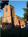

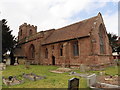
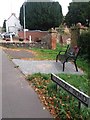
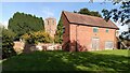

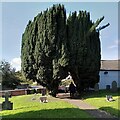
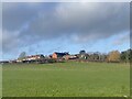
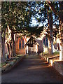

14 photos from this area
Area Information
Key information about the CV7 8FT including its size, population, and administrative classification.
- Area Type
- Postcode
- Area Size
- 8141 m²
- Population
- 1481
- Population Density
- 1019 people/km²
House Prices in CV7 8FT
44
Properties
£120,334
Average Sold Price
£23,000
Lowest Price
£290,000
Highest Price
Showing 44 properties
| Address | Type | Beds | Baths | Last Sale Price | Last Sale Date | |
|---|---|---|---|---|---|---|
| 4, St Wilfreds Cottages, Ansley Lane, Arley, CV7 8FT | house | - | - | £206,500 | Sep 2022 | |
| 41, St Wilfreds Cottages, Ansley Lane, Arley, CV7 8FT | house | - | - | £185,000 | Jun 2021 | |
| St Wilfreds House, Ansley Lane, Arley, CV7 8FT | Detached | 4 | 1 | £290,000 | Sep 2020 | |
| 9, St Wilfreds Cottages, Ansley Lane, Arley, CV7 8FT | house | - | - | £150,000 | Jan 2020 | |
| 6, St Wilfreds Cottages, Ansley Lane, Arley, CV7 8FT | Terraced | 2 | 1 | £172,000 | Aug 2017 | |
| 16, St Wilfreds Cottages, Ansley Lane, Arley, CV7 8FT | house | - | - | £150,000 | Feb 2016 | |
| 25, St Wilfreds Cottages, Ansley Lane, Arley, CV7 8FT | house | - | - | £110,000 | Jul 2015 | |
| 13, St Wilfreds Cottages, Ansley Lane, Arley, CV7 8FT | house | - | - | £145,000 | Feb 2015 | |
| 12, St Wilfreds Cottages, Ansley Lane, Arley, CV7 8FT | Terraced | 2 | - | £163,000 | Aug 2014 | |
| 24, St Wilfreds Cottages, Ansley Lane, Arley, CV7 8FT | house | - | - | £146,000 | Dec 2013 |
Page 1 of 5
Energy Efficiency in CV7 8FT
Amenities
Schools
| Rank | School | Type | Entry gender | Ages |
|---|
Explore more schools in this area
Go to Schools tabDemographics
Household Size
One person
most common
Accommodation Type
Houses
most common
Tenure
66
majority
Ethnic Group
White
most common
Religion
N/A
most common
Household Composition
N/A
most common
Age
47
median
Adults (30-64 years)
most common
Household Deprivation
N/A
with no deprivation
NS-SEC
28
in Lower managerial occupations
Explore more demographic insights in this area
Go to Demographics tabPlanning
Planning Constraints
- Flood RiskPremium
- Ramsar Wetland SitesPremium
- Area of Outstanding Natural BeautyPremium
- Protected Nature ReservePremium
- Protected WoodlandPremium