Area Overview for CV7 8FW
Photos of CV7 8FW
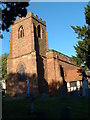

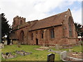
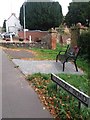
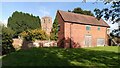
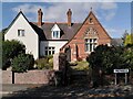
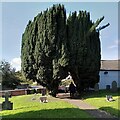
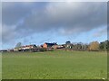
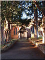
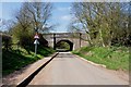
14 photos from this area
Area Information
Key information about the CV7 8FW including its size, population, and administrative classification.
- Area Type
- Postcode
- Area Size
- 21.8 hectares
- Population
- 1481
- Population Density
- 1019 people/km²
House Prices in CV7 8FW
48
Properties
£136,621
Average Sold Price
£31,000
Lowest Price
£265,000
Highest Price
Showing 48 properties
| Address | Type | Beds | Baths | Last Sale Price | Last Sale Date | |
|---|---|---|---|---|---|---|
| 1A Church Lane, Old Arley, Arley, CV7 8FW | Detached | 4 | 1 | £265,000 | Jul 2025 | |
| 3A Church Lane, Old Arley, Arley, CV7 8FW | Semi-detached | 3 | 1 | £238,500 | Feb 2025 | |
| 31 Church Lane, Old Arley, Arley, CV7 8FW | Terraced | 2 | 1 | £230,000 | Feb 2024 | |
| 2 Church Lane, Old Arley, Arley, CV7 8FW | house | - | - | £238,000 | Jan 2022 | |
| 33 Church Lane, Old Arley, Arley, CV7 8FW | house | - | - | £245,000 | Sep 2021 | |
| 1 Church Lane, Old Arley, Arley, CV7 8FW | Terraced | 2 | 2 | £227,150 | Jun 2021 | |
| 3 Church Lane, Old Arley, Arley, CV7 8FW | Terraced | 3 | 1 | £180,000 | Nov 2020 | |
| 36 Church Lane, Old Arley, Arley, CV7 8FW | house | - | - | £180,000 | Aug 2019 | |
| 29 Church Lane, Old Arley, Arley, CV7 8FW | Terraced | 2 | - | £175,000 | Jan 2017 | |
| 27 Church Lane, Old Arley, Arley, CV7 8FW | house | - | - | £116,000 | Nov 2015 |
Page 1 of 5
Energy Efficiency in CV7 8FW
Amenities
Schools
| Rank | School | Type | Entry gender | Ages |
|---|
Explore more schools in this area
Go to Schools tabDemographics
Household Size
One person
most common
Accommodation Type
Houses
most common
Tenure
66
majority
Ethnic Group
White
most common
Religion
N/A
most common
Household Composition
N/A
most common
Age
47
median
Adults (30-64 years)
most common
Household Deprivation
N/A
with no deprivation
NS-SEC
28
in Lower managerial occupations
Explore more demographic insights in this area
Go to Demographics tabPlanning
Planning Constraints
- Flood RiskPremium
- Ramsar Wetland SitesPremium
- Area of Outstanding Natural BeautyPremium
- Protected Nature ReservePremium
- Protected WoodlandPremium