Area Overview for CV6 2JG
Photos of CV6 2JG
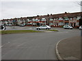
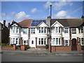
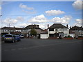
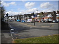
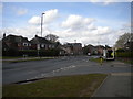
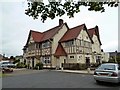
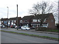
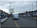
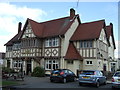
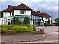
18 photos from this area
Area Information
Key information about the CV6 2JG including its size, population, and administrative classification.
- Area Type
- Postcode
- Area Size
- 1.4 hectares
- Population
- 1620
- Population Density
- 6950 people/km²
House Prices in CV6 2JG
25
Properties
£152,306
Average Sold Price
£50,000
Lowest Price
£360,000
Highest Price
Showing 25 properties
| Address | Type | Beds | Baths | Last Sale Price | Last Sale Date | |
|---|---|---|---|---|---|---|
| 1 Stennels Close, Coventry, CV6 2JG | Semi-detached | 3 | 2 | £260,000 | Jun 2021 | |
| 45 Stennels Close, Coventry, CV6 2JG | Detached | 4 | 3 | £360,000 | May 2017 | |
| 27 Stennels Close, Coventry, CV6 2JG | house | - | - | £158,000 | Dec 2014 | |
| 19 Stennels Close, Coventry, CV6 2JG | house | - | - | £141,500 | Aug 2013 | |
| 13 Stennels Close, Coventry, CV6 2JG | house | - | - | £150,000 | Jun 2011 | |
| 5 Stennels Close, Coventry, CV6 2JG | house | 3 | - | £170,000 | Jul 2010 | |
| 31 Stennels Close, Coventry, CV6 2JG | Semi-detached | 3 | 1 | £173,500 | Mar 2010 | |
| 7 Stennels Close, Coventry, CV6 2JG | house | - | - | £157,000 | Oct 2009 | |
| 33 Stennels Close, Coventry, CV6 2JG | Semi-detached | - | - | £151,000 | Oct 2008 | |
| 29 Stennels Close, Coventry, CV6 2JG | Semi-detached | - | - | £150,000 | Oct 2005 |
Page 1 of 3
Energy Efficiency in CV6 2JG
Amenities
Schools
| Rank | School | Type | Entry gender | Ages |
|---|
Explore more schools in this area
Go to Schools tabDemographics
Household Size
Family (3-5 people)
most common
Accommodation Type
Houses
most common
Tenure
70
majority
Ethnic Group
White
most common
Religion
N/A
most common
Household Composition
N/A
most common
Age
47
median
Adults (30-64 years)
most common
Household Deprivation
N/A
with no deprivation
NS-SEC
28
in Lower managerial occupations
Explore more demographic insights in this area
Go to Demographics tabPlanning
Planning Constraints
- Flood RiskPremium
- Ramsar Wetland SitesPremium
- Area of Outstanding Natural BeautyPremium
- Protected Nature ReservePremium
- Protected WoodlandPremium