Area Overview for CV4 9AH
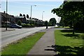
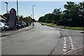
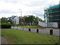
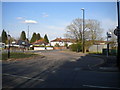
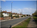
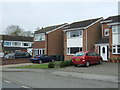
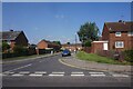
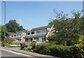
Photos of CV4 9AH


Area Information
Living in CV4 9AH offers a settled existence within a small residential cluster in Coventry, West Midlands. This postcode covers just 0.006 square kilometres, home to a population of approximately 1,600 people. The area functions as a distinct community unit, separate yet connected to the wider Woodlands Ward. Residents benefit from a compact environment where neighbours are close by, creating a tight-knit atmosphere. The location is situated near key Coventry landmarks, including Woodlands School, a historic site dating back to the mid-20th century. The ward's history includes its incorporation into Warwickshire in 1842, adding depth to the local character. Daily life here revolves around practical convenience and a stable community feel. You will find yourself surrounded by a mix of families and long-term residents who value stability. The area avoids major planning constraints, ensuring that future development remains manageable. Buying a home here means entering a space defined by its history and its current role as a quiet residential haven. The small size of the area means noise and activity levels are generally contained, providing a peaceful backdrop for family life.
- Area Type
- Postcode
- Area Size
- 6070 m²
- Population
- 1600
- Population Density
- 6403 people/km²
The housing market in CV4 9AH is characterised by strong owner-occupancy, with 55% of homes owned outright or with a mortgage. This figure signals a settled market where residents have a vested interest in their properties and the area's long-term stability. The predominant accommodation type is houses, suggesting a landscape of detached or semi-detached homes typical of suburban or semi-rural settings within Coventry. This contrasts sharply with high-density urban centres. Buyers looking for homes in CV4 9AH will find a stock suited to families and those seeking space. The small footprint of the postcode, covering only 6,070 square metres, limits the total volume of available properties but increases the exclusivity for those who secure one. This is likely an owner-driven market rather than a rental hub. The historical context of the area, including the presence of Woodlands School, adds to the appeal of the local housing stock. Properties here represent a solid investment for buyers prioritising established communities over new builds. The mix of heritage buildings and modern housing suggests a diverse yet cohesive architectural environment.
House Prices in CV4 9AH
Showing 21 properties
| Address | Type | Beds | Baths | Last Sale Price | Last Sale Date | |
|---|---|---|---|---|---|---|
| 16 Mohawk Bend, Coventry, CV4 9AH | Semi-detached | 3 | 1 | £265,000 | Jun 2023 | |
| 14 Mohawk Bend, Coventry, CV4 9AH | Semi-detached | 3 | 1 | £230,000 | Oct 2019 | |
| 15 Mohawk Bend, Coventry, CV4 9AH | Detached | 3 | 2 | £260,000 | Oct 2016 | |
| 7 Mohawk Bend, Coventry, CV4 9AH | Detached | 5 | - | £375,000 | Mar 2015 | |
| 12 Mohawk Bend, Coventry, CV4 9AH | house | 2 | - | £64,950 | Nov 2013 | |
| 21 Mohawk Bend, Coventry, CV4 9AH | Terraced | 3 | 1 | £73,000 | Nov 2010 | |
| 1 Mohawk Bend, Coventry, CV4 9AH | Semi-detached | 3 | 2 | £184,995 | Aug 2010 | |
| 2 Mohawk Bend, Coventry, CV4 9AH | house | - | - | £166,245 | Oct 2008 | |
| 9 Mohawk Bend, Coventry, CV4 9AH | Detached | - | - | £299,950 | Jun 2008 | |
| 5 Mohawk Bend, Coventry, CV4 9AH | Detached | - | - | £343,000 | Feb 2008 |
Energy Efficiency in CV4 9AH
Living in CV4 9AH places you within easy reach of essential amenities and leisure options. Retail conveniences include a Spar, Farmfoods Allesley, and Budgens Jardine, ensuring you do not need to travel far for groceries. For dining and other shopping, Tile Hill, Berkswell, and Canley offer additional variety. The area is further enhanced by access to multiple transport hubs, including five nearby railway stations. You can access Birmingham International Railway Station for long-distance travel, while Coventry Airport is located just two stations away, providing quick links to national and international destinations. Woodlands School, a listed building complex on Broad Lane, stands as a notable local feature and historical landmark. The presence of this heritage site adds character to the neighbourhood, offering a connection to the area's mid-20th-century history. While the immediate postcode is small, the surrounding wards provide a rich network of services. You can enjoy a lifestyle that balances suburban comfort with urban accessibility. The mix of independent shops and larger retail chains caters to varied needs, from quick errands to household shopping.
Amenities
Schools
| Rank | School | Type | Entry gender | Ages |
|---|
Explore more schools in this area
Go to Schools tabDemographics
The community defining CV4 9AH is mature and stable, with a median age of 47 years. The population consists predominantly of adults aged between 30 and 64 years. This age profile suggests a neighbourhood where families with children and established households find their place. House ownership stands at 55%, indicating that more than half of the residents are likely to be owners rather than tenants. This high rate of owner-occupancy contributes to the area's sense of permanence and investment in local improvements. The primary accommodation type found here are houses, reinforcing the family-oriented character of the cluster. The predominant ethnic group among residents is White, reflecting a demographically homogeneous community. The low population density for an urban setting is notable, though the specific density figure is exceptionally high per square kilometre due to the tiny postcode area size. Regardless of the metric, the area feels intimate. You are purchasing into a demographic that values established routines. The age profile means you can expect a neighbourhood free from the volatility associated with younger populations, favouring quieter streets and consistent community standards.
Household Size
Accommodation Type
Tenure
Ethnic Group
Religion
Household Composition
Age
Household Deprivation
NS-SEC
Explore more demographic insights in this area
Go to Demographics tabPlanning
Planning Constraints
- Flood RiskPremium
- Ramsar Wetland SitesPremium
- Area of Outstanding Natural BeautyPremium
- Protected Nature ReservePremium
- Protected WoodlandPremium