Area Overview for CV4 9BF
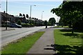
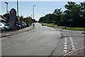
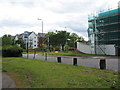
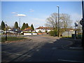
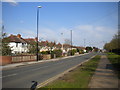
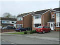
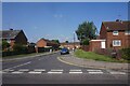
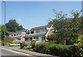
Photos of CV4 9BF


Area Information
Living in CV4 9BF offers a defined experience within the Woodlands Ward of Coventry, West Midlands. This specific postcode covers a small residential cluster spanning 3.2 hectares. You are looking at a community of approximately 1,600 people, resulting in a very high population density of 49,795 people per square kilometre. The area sits within a city with documented origins tracing back to a Saxon nunnery founded by St Osburga around AD 700. Coventry itself gained city status in 1345 under King Edward III. The modern character of CV4 9BF is shaped by its proximity to significant local institutions. The area is anchored by Woodlands School on Broad Lane. This facility opened in September 1954 as one of the first purpose-built comprehensive schools in the country. The school complex features heritage buildings constructed using the Hills system, including the Arts and Crafts block and Gibraltar House. These structures were built during phases in 1954 and 1957 after initial plans were made to utilise prefabricated components. Daily life here is characterised by the constraints and advantages of a compact residential zone. Residents live in close association with one another due to the limited area size. The historical context of the region adds a layer of depth to the location, distinguishing it from other new builds in the wider Coventry region. When considering a home here, you are entering an environment where post-war planning precedes modern suburban sprawl.
- Area Type
- Postcode
- Area Size
- 3.2 hectares
- Population
- 1600
- Population Density
- 6403 people/km²
The property market in CV4 9BF is defined by a predominance of houses and a significant owner-occupier base. One hundred and sixty households own their homes, representing 55 per cent of the area. The remaining 45 per cent are likely private renters or those moving into the market for the first time. This split creates a market where sale transactions are as common as long-term tenancies. Because CV4 9BF covers only 3.2 hectares, the selection of specific stock is limited. You will find a concentration of houses that reflect the post-war development era of the Woodlands Ward. Unlike generic large developments, this estate comprises a specific cluster of properties. The accumulation of homes in this postcode suggests a tight-knit residential group rather than a sprawling suburb. Potential buyers looking at homes in CV4 9BF should consider the implications of the high population density. You are purchasing within a zone where 1,600 people occupy a very small land area. This density affects the quietness and outdoor space available at your doorstep. The market here is not speculative; it serves the immediate needs of the Woodlands Ward population. The 55 per cent ownership figure indicates that many homes have remained with the same families for considerable periods. This stability often positively influences the value and maintenance of the housing stock. When viewing properties, expect a range of established homes rather than brand-new builds. The market caters to buyers seeking a home in an area with a defined character and existing community infrastructure.
House Prices in CV4 9BF
Showing 94 properties
| Address | Type | Beds | Baths | Last Sale Price | Last Sale Date | |
|---|---|---|---|---|---|---|
| 68 Philmont Court, Coventry, CV4 9BF | Flat | 2 | 1 | £134,000 | Jun 2025 | |
| 32 Philmont Court, Coventry, CV4 9BF | Flat | 2 | 1 | £170,000 | Apr 2025 | |
| 72 Philmont Court, Coventry, CV4 9BF | Flat | - | - | £122,500 | Mar 2025 | |
| 37 Philmont Court, Coventry, CV4 9BF | Flat | - | - | £135,000 | Mar 2025 | |
| 8 Philmont Court, Coventry, CV4 9BF | Flat | - | - | £158,500 | Dec 2024 | |
| 36 Philmont Court, Coventry, CV4 9BF | Flat | 2 | 1 | £82,500 | Dec 2024 | |
| 18 Philmont Court, Coventry, CV4 9BF | Flat | - | - | £145,000 | Nov 2024 | |
| 52 Philmont Court, Coventry, CV4 9BF | Flat | - | - | £145,000 | Oct 2024 | |
| 81 Philmont Court, Coventry, CV4 9BF | Flat | - | - | £159,950 | Jul 2024 | |
| 11 Philmont Court, Coventry, CV4 9BF | Flat | - | - | £170,000 | Jul 2024 |
Energy Efficiency in CV4 9BF
Your lifestyle in CV4 9BF revolves around practical amenities within walking or short driving distance. Five retail outlets serve the local shopping needs. These include Spar, Farmfoods Allesley, and Budgens Jardine. You will find fresh groceries, household essentials, and everyday goods readily available without needing a long trip. Transport links are woven into your daily routine. Five railway stations serve the local area, including Tile Hill, Berkswell, and Canley. This density of stations is unusual for a single ward and suggests exceptional connectivity to the wider Midlands network. For business travel, five airports, both Codenamed Coventry Airport, offer regional flights. Additionally, Birmingham International Railway Station acts as a major metro hub nearby. The presence of Woodlands School on Broad Lane anchors the social and educational environment. This school, notable for its Hills 3'4" construction and Arts and Crafts block, is a central feature of the community. The school's status as a listed building adds a cultural element to daily life. Families benefit from a local institution with recognised architectural merit and a long history dating back to 1954. Living here means balancing urban convenience with local neighbourhood stability. You have immediate access to supermarkets and rapid rail links, yet you reside within a defined 3.2-hectare cluster. The mix of retail, transport, and education creates a functional environment. Daily errands are efficient, and commutes are manageable due to the variety of available stations.
Amenities
Schools
| Rank | School | Type | Entry gender | Ages |
|---|
Explore more schools in this area
Go to Schools tabDemographics
The community profile of CV4 9BF reflects a mature, established population. The median age for residents is 47 years, with the most common age range falling between 30 and 64 years. This indicates a neighbourhood dominated by adults rather than families with young children or empty-nesters over the age of 65. Home ownership stands at 55 per cent of the total population. This figure suggests a balanced mix of owner-occupiers and private renters, though you should be aware that just over half of the households belong to those who own their property outright or with a mortgage. The majority of the population identifies as White, which aligns with the broader demographic trends of the Woodlands Ward and Coventry city. The predominant accommodation type in this postcode is houses. Given the high density of 49,795 people per square kilometre, the arrangement of these houses is likely compact within the 3.2-hectare boundary. You will not find a high proportion of purpose-built flats or high-rise apartments compared to the wider city centre. Instead, the stock consists of detached, semi-detached, or terraced housing units adapted to a dense urban ward. Deprivation data is not included in the current records for this specific cluster. However, the age profile and high home ownership rate point towards stability. The area attracts individuals who have chosen to settle in Coventry for family reasons or employment rather than seeking rapid growth or transient communities. Living here means engaging with a demographic that values proximity to local schools and established neighbourhoods.
Household Size
Accommodation Type
Tenure
Ethnic Group
Religion
Household Composition
Age
Household Deprivation
NS-SEC
Explore more demographic insights in this area
Go to Demographics tabPlanning
Planning Constraints
- Flood RiskPremium
- Ramsar Wetland SitesPremium
- Area of Outstanding Natural BeautyPremium
- Protected Nature ReservePremium
- Protected WoodlandPremium