Area Overview for CV4 8AA
Photos of CV4 8AA
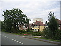
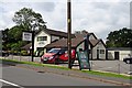
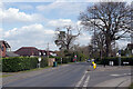

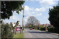
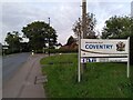
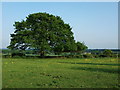
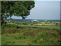

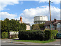

17 photos from this area
Area Information
Key information about the CV4 8AA including its size, population, and administrative classification.
- Area Type
- Postcode
- Area Size
- 22.1 hectares
- Population
- 1705
- Population Density
- 106 people/km²
House Prices in CV4 8AA
49
Properties
£470,520
Average Sold Price
£119,950
Lowest Price
£890,000
Highest Price
Showing 49 properties
| Address | Type | Beds | Baths | Last Sale Price | Last Sale Date | |
|---|---|---|---|---|---|---|
| 456 Westwood Heath Road, Coventry, CV4 8AA | Bungalow | 2 | 2 | £480,000 | Sep 2025 | |
| 442 Westwood Heath Road, Coventry, CV4 8AA | Detached | 4 | 3 | £850,000 | Feb 2025 | |
| 454 Westwood Heath Road, Coventry, CV4 8AA | Detached | 5 | 3 | £475,000 | Feb 2023 | |
| 573 Westwood Heath Road, Coventry, CV4 8AA | Detached | 4 | - | £625,000 | Aug 2021 | |
| 438 Westwood Heath Road, Coventry, CV4 8AA | house | - | - | £890,000 | Mar 2021 | |
| 452 Westwood Heath Road, Coventry, CV4 8AA | house | - | - | £543,000 | Jan 2021 | |
| 611 Westwood Heath Road, Coventry, CV4 8AA | Detached | 4 | 3 | £555,000 | Sep 2020 | |
| 595 Westwood Heath Road, Coventry, CV4 8AA | Semi-detached | 3 | 2 | £365,500 | Aug 2019 | |
| 597 Westwood Heath Road, Coventry, CV4 8AA | Detached | 3 | 1 | £465,000 | May 2018 | |
| Lodge Farm House, Westwood Heath Road, Coventry, CV4 8AA | Detached | 6 | 5 | £825,000 | Jun 2017 |
Page 1 of 5
Energy Efficiency in CV4 8AA
Amenities
Schools
| Rank | School | Type | Entry gender | Ages |
|---|
Explore more schools in this area
Go to Schools tabDemographics
Household Size
Two person
most common
Accommodation Type
Houses
most common
Tenure
83
majority
Ethnic Group
White
most common
Religion
N/A
most common
Household Composition
N/A
most common
Age
47
median
Adults (30-64 years)
most common
Household Deprivation
N/A
with no deprivation
NS-SEC
51
in Lower managerial occupations
Explore more demographic insights in this area
Go to Demographics tabPlanning
Planning Constraints
- Flood RiskPremium
- Ramsar Wetland SitesPremium
- Area of Outstanding Natural BeautyPremium
- Protected Nature ReservePremium
- Protected WoodlandPremium