Area Overview for CV4 8GX
Photos of CV4 8GX
Area Information
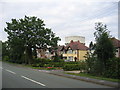
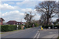
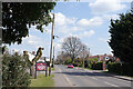
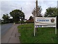
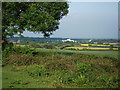
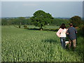
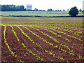
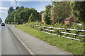
Living in CV4 8GX means residing in a small residential cluster defined by a specific postcode covering 1.3 hectares. This location sits within the broader Westwood Ward of Coventry, an area that was incorporated into the city in 1927 after evolving from the Stoneleigh Estate. The terrain blends semi-rural elements with suburban development, featuring enclosed farmland and ribbon housing along routes like Westwood Heath Road. The median age of 47 indicates a mature demographic, with adults aged between 30 and 64 forming the most common age range. You are part of a community where 82% of residents own their homes, creating a neighbourhood built for stability rather than transient living. The population stands at 1913 people, resulting in a density of 1429 people per square kilometre. This concentration creates a close-knit environment without the overwhelming sprawl of larger urban districts. Historically significant sites, such as the St John the Baptist Church built in 1844, anchor the area, while former common land and Cistercian monk granges remain part of the local narrative. Daily life here balances access to the city with the quiet character of a suburb that still retains traces of its agricultural past.
- Area Type
- Postcode
- Area Size
- 1.3 hectares
- Population
- 1913
- Population Density
- 1429 people/km²
The property market in CV4 8GX is defined by a strong preference for owned dwellings. With 82% home ownership, the area is predominantly owner-occupied rather than a rental-heavy zone. This statistic indicates that buyers here invest in the area rather than lease temporary accommodation. The accommodation type is listed as houses, which reinforces the suburban character of this 1.3 hectare cluster. You will find that the housing stock consists of structures designed for families, likely including detached or semi-detached homes common in roads like Cromwell Lane. The history of the area, transitioning from agricultural land to suburban development since the 20th century, has created a stable housing environment. The 82% figure suggests that securing a property here is often about purchasing a forever home rather than renting a flat. This market reality means price stability and capital growth are likely priorities for residents. The lack of varied accommodation types, such as blocks of flats, simplifies the buying experience for those seeking traditional family homes. Buyers looking for this postcode should expect a market driven by sales and long-term ownership rather than the turnover associated with private renting.
House Prices in CV4 8GX
Showing 9 properties
| Address | Type | Beds | Baths | Last Sale Price | Last Sale Date | |
|---|---|---|---|---|---|---|
| 10 Roughknowles Road, Coventry, CV4 8GX | Detached | 5 | - | £540,000 | May 2010 | |
| 4 Roughknowles Road, Coventry, CV4 8GX | Detached | 5 | - | £595,000 | Nov 2006 | |
| 2 Roughknowles Road, Coventry, CV4 8GX | Detached | - | - | £585,000 | Sep 2006 | |
| 22 Roughknowles Road, Coventry, CV4 8GX | Detached | - | - | £635,000 | May 2006 | |
| 8 Roughknowles Road, Coventry, CV4 8GX | Detached | - | - | £575,000 | Dec 2005 | |
| 6 Roughknowles Road, Coventry, CV4 8GX | Detached | 5 | - | £645,000 | Dec 2005 | |
| 24 Roughknowles Road, Coventry, CV4 8GX | Detached | - | - | £173,000 | Apr 1999 | |
| 26 Roughknowles Road, Coventry, CV4 8GX | Detached | - | - | £150,000 | Feb 1995 | |
| 5 Roughknowles Road, Coventry, CV4 8GX | Detached | - | - | - | - |
Energy Efficiency in CV4 8GX
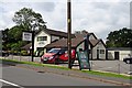
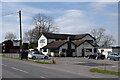
Residents of CV4 8GX have several amenities within practical reach for daily errands and leisure. Retail options include Farmfoods Allesley, Budgens Jardine, and the larger Costco Coventry, offering diverse shopping choices for groceries and household goods. You have access to rail transport with five stations nearby, including Tile Hill Railway Station, Canley Railway Station, and Berkswell Railway Station. These stations provide links to broader transport networks without needing to travel far into the city centre. There are two airports in the immediate vicinity, both identified as Coventry Airport, offering potential travel convenience for residents with private jet access or specific business needs. The retail count of five outlets ensures you do not need to leave the locality for basic shopping tasks. Dining is supported by the various former outlets and local eateries typical of this suburban setting. The proximity to Stoneleigh and other nearby villages enhances the quality of life. You can utilise the Network Rail Training College as a point of interest or visitor destination. This combination of rail access, retail variety, and proximity to airports creates a functional lifestyle for those working either locally or nationally.
Amenities
Schools
Families living in CV4 8GX have access to a range of educational institutions nearby. You can find The Westwood School, a primary school, serving younger children. Further education is supported by The Westwood Academy, an academy with a good Ofsted rating. For secondary education, the WMG Academy for Young Engineers stands out, also holding a good Ofsted rating. There is also The National Mathematics and Science College, an independent school with a good Ofsted rating, though this serves a selective or alternative sector. The presence of two institutions with good Ofsted ratings provides reassurance regarding the quality of mainstream education available to local families. The mix of state, academy, and independent sectors offers choices depending on your educational preferences. Primary education begins at The Westwood School, while secondary stages are managed by either The Westwood Academy or the specialist math and science focus of The National Mathematics and Science College. Children do not need to commute far as credible schools are located in the immediate vicinity of this postcode. This educational landscape supports the demographic profile of families with children in the 30 to 64 age range.
| Rank | School | Type | Entry gender | Ages |
|---|
Explore more schools in this area
Go to Schools tabDemographics
The community profile for this postcode is distinct, with 82% of residents owning their homes. This high rate of ownership signals a settled population who view their properties as long-term assets. Accommodation consists primarily of houses, supporting families and individuals seeking spacious living environments rather than flat-based housing. The most common age range for residents falls between 30 and 64 years, with a median age of 47. This suggests the area attracts older families, established professionals, and those looking to settle down rather than young renters starting out. White residents form the predominant ethnic group, reflecting the broader historical demographics of the Westwood Ward. The lack of young people under 30 or retirees over 64 as the majority demographic means the area may feel dominated by middle-aged households. While specific deprivation indices are not provided in the current dataset, the high home ownership and mature age profile imply a stable, less volatile community. You can expect a neighbourhood where neighbours have been living for years, fostering quiet streets and established social ties. This demographic structure supports local businesses catering to family needs and mature lifestyles.
Household Size
Accommodation Type
Tenure
Ethnic Group
Religion
Household Composition
Age
Household Deprivation
NS-SEC
Explore more demographic insights in this area
Go to Demographics tabPlanning
Planning Constraints
- Flood RiskPremium
- Ramsar Wetland SitesPremium
- Area of Outstanding Natural BeautyPremium
- Protected Nature ReservePremium
- Protected WoodlandPremium