Area Overview for CV4 8AP
Photos of CV4 8AP
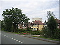
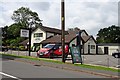

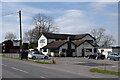
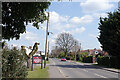
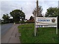


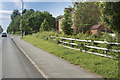
17 photos from this area
Area Information
Key information about the CV4 8AP including its size, population, and administrative classification.
- Area Type
- Postcode
- Area Size
- 20.7 hectares
- Population
- 1880
- Population Density
- 237 people/km²
House Prices in CV4 8AP
42
Properties
£337,912
Average Sold Price
£110,000
Lowest Price
£710,000
Highest Price
Showing 42 properties
| Address | Type | Beds | Baths | Last Sale Price | Last Sale Date | |
|---|---|---|---|---|---|---|
| 176 Cromwell Lane, Burton Green, Kenilworth, CV4 8AP | Bungalow | 2 | 1 | £288,250 | Feb 2024 | |
| 184 Cromwell Lane, Burton Green, Kenilworth, CV4 8AP | Semi-detached | 3 | 2 | £347,000 | Oct 2023 | |
| 166 Cromwell Lane, Coventry, CV4 8AP | Detached | 3 | 1 | £372,000 | Oct 2022 | |
| 170A Cromwell Lane, Burton Green, Kenilworth, CV4 8AP | Bungalow | 3 | 1 | £342,500 | May 2022 | |
| 138 Cromwell Lane, Coventry, CV4 8AP | house | 11 | - | £630,000 | Jan 2022 | |
| The Cottage, 262 Cromwell Lane, Burton Green, Kenilworth, CV4 8AP | Detached | 2 | 2 | £385,000 | Dec 2021 | |
| 158 Cromwell Lane, Coventry, CV4 8AP | house | - | - | £340,000 | Sep 2021 | |
| 142 Cromwell Lane, Coventry, CV4 8AP | house | - | - | £660,000 | Jun 2021 | |
| 140 Cromwell Lane, Coventry, CV4 8AP | Bungalow | - | - | £485,000 | Oct 2019 | |
| 170 Cromwell Lane, Burton Green, Kenilworth, CV4 8AP | Detached | 5 | 3 | £675,000 | Oct 2019 |
Page 1 of 5
Energy Efficiency in CV4 8AP
Amenities
Schools
| Rank | School | Type | Entry gender | Ages |
|---|
Explore more schools in this area
Go to Schools tabDemographics
Household Size
Family (3-5 people)
most common
Accommodation Type
Houses
most common
Tenure
87
majority
Ethnic Group
White
most common
Religion
N/A
most common
Household Composition
N/A
most common
Age
47
median
Adults (30-64 years)
most common
Household Deprivation
N/A
with no deprivation
NS-SEC
50
in Lower managerial occupations
Explore more demographic insights in this area
Go to Demographics tabPlanning
Planning Constraints
- Flood RiskPremium
- Ramsar Wetland SitesPremium
- Area of Outstanding Natural BeautyPremium
- Protected Nature ReservePremium
- Protected WoodlandPremium