Area Overview for CV3 6PT
Photos of CV3 6PT


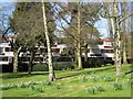
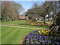
100 photos from this area
Area Information
Key information about the CV3 6PT including its size, population, and administrative classification.
- Area Type
- Postcode
- Area Size
- 6.8 hectares
- Population
- 1343
- Population Density
- 1417 people/km²
House Prices in CV3 6PT
12
Properties
£642,922
Average Sold Price
£463,766
Lowest Price
£975,000
Highest Price
Showing 12 properties
| Address | Type | Beds | Baths | Last Sale Price | Last Sale Date | |
|---|---|---|---|---|---|---|
| 10 Kenilworth Road, Coventry, CV3 6PT | house | - | - | £975,000 | Sep 2021 | |
| 14A Kenilworth Road, Coventry, CV3 6PT | Detached | 4 | 2 | £463,766 | Jan 2021 | |
| 14 Kenilworth Road, Coventry, CV3 6PT | Detached | 4 | 2 | £490,000 | Mar 2004 | |
| Tennis Courts, War Memorial Park, Kenilworth Road, Coventry, CV3 6PT | Leisure | - | - | - | - | |
| Bowling Greens, Kenilworth Road, Coventry, CV3 6PT | pub | - | - | - | - | |
| Tennis 182M From 14A, Kenilworth Road 36M From Unnamed Road, Kenilworth Road, Coventry, CV3 6PT | Leisure | - | - | - | - | |
| Tennis 210M From 14A, Kenilworth Road 32M From Unnamed Road, Kenilworth Road, Coventry, CV3 6PT | Leisure | - | - | - | - | |
| The Park Bistro, War Memorial Park, Kenilworth Road, Coventry, CV3 6PT | office_workshop | - | - | - | - | |
| The Sundae Club, War Memorial Park, Kenilworth Road, Coventry, CV3 6PT | Restaurant | - | - | - | - | |
| 16 Kenilworth Road, Coventry, CV3 6PT | Detached | - | - | - | - |
Page 1 of 2
Energy Efficiency in CV3 6PT
Amenities
Schools
| Rank | School | Type | Entry gender | Ages |
|---|
Explore more schools in this area
Go to Schools tabDemographics
Household Size
One person
most common
Accommodation Type
Houses
most common
Tenure
84
majority
Ethnic Group
White
most common
Religion
N/A
most common
Household Composition
N/A
most common
Age
47
median
Adults (30-64 years)
most common
Household Deprivation
N/A
with no deprivation
NS-SEC
50
in Lower managerial occupations
Explore more demographic insights in this area
Go to Demographics tabPlanning
Planning Constraints
- Flood RiskPremium
- Ramsar Wetland SitesPremium
- Area of Outstanding Natural BeautyPremium
- Protected Nature ReservePremium
- Protected WoodlandPremium