Area Overview for CV3 6GJ
Photos of CV3 6GJ

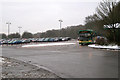

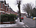


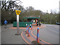
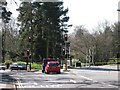
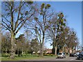
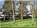

100 photos from this area
Area Information
Key information about the CV3 6GJ including its size, population, and administrative classification.
- Area Type
- Postcode
- Area Size
- 21.1 hectares
- Population
- 1343
- Population Density
- 1417 people/km²
House Prices in CV3 6GJ
44
Properties
£401,306
Average Sold Price
£146,000
Lowest Price
£700,000
Highest Price
Showing 44 properties
| Address | Type | Beds | Baths | Last Sale Price | Last Sale Date | |
|---|---|---|---|---|---|---|
| 90 Armorial Road, Coventry, CV3 6GJ | Detached | 5 | 3 | £650,000 | Jun 2021 | |
| 22 Armorial Road, Coventry, CV3 6GJ | Detached | 4 | 2 | £700,000 | Jun 2019 | |
| 54 Armorial Road, Coventry, CV3 6GJ | Detached | 7 | 6 | £530,000 | Oct 2018 | |
| 20 Armorial Road, Coventry, CV3 6GJ | Detached | 4 | 2 | £530,000 | May 2018 | |
| 90A Armorial Road, Coventry, CV3 6GJ | Detached | 5 | - | £499,950 | Nov 2015 | |
| 38 Armorial Road, Coventry, CV3 6GJ | Detached | 4 | - | £420,000 | Mar 2015 | |
| 32 Armorial Road, Coventry, CV3 6GJ | Detached | 5 | - | £418,500 | Dec 2013 | |
| 50 Armorial Road, Coventry, CV3 6GJ | house | - | - | £475,000 | Dec 2013 | |
| 78 Armorial Road, Coventry, CV3 6GJ | house | - | - | £370,000 | Oct 2012 | |
| 58 Armorial Road, Coventry, CV3 6GJ | house | - | - | £380,000 | Feb 2012 |
Page 1 of 5
Energy Efficiency in CV3 6GJ
Amenities
Schools
| Rank | School | Type | Entry gender | Ages |
|---|
Explore more schools in this area
Go to Schools tabDemographics
Household Size
One person
most common
Accommodation Type
Houses
most common
Tenure
84
majority
Ethnic Group
White
most common
Religion
N/A
most common
Household Composition
N/A
most common
Age
47
median
Adults (30-64 years)
most common
Household Deprivation
N/A
with no deprivation
NS-SEC
50
in Lower managerial occupations
Explore more demographic insights in this area
Go to Demographics tabPlanning
Planning Constraints
- Flood RiskPremium
- Ramsar Wetland SitesPremium
- Area of Outstanding Natural BeautyPremium
- Protected Nature ReservePremium
- Protected WoodlandPremium