Area Overview for CV3 6GF
Photos of CV3 6GF

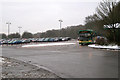
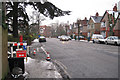
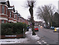


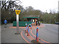
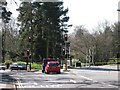
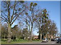
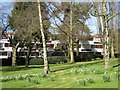
100 photos from this area
Area Information
Key information about the CV3 6GF including its size, population, and administrative classification.
- Area Type
- Postcode
- Area Size
- 7.2 hectares
- Population
- 1343
- Population Density
- 1417 people/km²
House Prices in CV3 6GF
24
Properties
£480,953
Average Sold Price
£150,000
Lowest Price
£730,000
Highest Price
Showing 24 properties
| Address | Type | Beds | Baths | Last Sale Price | Last Sale Date | |
|---|---|---|---|---|---|---|
| 13 Leamington Road, Coventry, CV3 6GF | Detached | 4 | 2 | £685,000 | Dec 2024 | |
| 19 Leamington Road, Coventry, CV3 6GF | Detached | 4 | 2 | £708,300 | Jun 2024 | |
| 39 Leamington Road, Coventry, CV3 6GF | Retail | 4 | 2 | £730,000 | Jul 2022 | |
| 17 Leamington Road, Coventry, CV3 6GF | house | - | - | £500,000 | Mar 2021 | |
| 43 Leamington Road, Coventry, CV3 6GF | Semi-detached | 4 | 2 | £540,000 | Nov 2019 | |
| 29 Leamington Road, Coventry, CV3 6GF | house | - | - | £391,000 | Apr 2017 | |
| 31A Leamington Road, Coventry, CV3 6GF | Flat | - | - | £300,000 | Dec 2016 | |
| 31 Leamington Road, Coventry, CV3 6GF | Maisonette | - | - | £150,000 | Dec 2016 | |
| 2 Leamington Road, Coventry, CV3 6GF | Detached | 4 | 3 | £490,000 | Sep 2016 | |
| 41 Leamington Road, Coventry, CV3 6GF | Semi-detached | 4 | 1 | £395,000 | Jul 2016 |
Page 1 of 3
Energy Efficiency in CV3 6GF
Amenities
Schools
| Rank | School | Type | Entry gender | Ages |
|---|
Explore more schools in this area
Go to Schools tabDemographics
Household Size
One person
most common
Accommodation Type
Houses
most common
Tenure
84
majority
Ethnic Group
White
most common
Religion
N/A
most common
Household Composition
N/A
most common
Age
47
median
Adults (30-64 years)
most common
Household Deprivation
N/A
with no deprivation
NS-SEC
50
in Lower managerial occupations
Explore more demographic insights in this area
Go to Demographics tabPlanning
Planning Constraints
- Flood RiskPremium
- Ramsar Wetland SitesPremium
- Area of Outstanding Natural BeautyPremium
- Protected Nature ReservePremium
- Protected WoodlandPremium