Area Overview for CV2 5GX
Photos of CV2 5GX
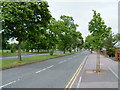
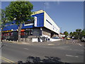
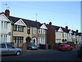
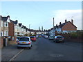
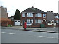
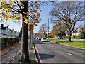
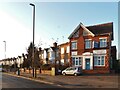
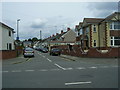


18 photos from this area
Area Information
Key information about the CV2 5GX including its size, population, and administrative classification.
- Area Type
- Postcode
- Area Size
- 6811 m²
- Population
- 1303
- Population Density
- 7062 people/km²
House Prices in CV2 5GX
21
Properties
£169,835
Average Sold Price
£45,000
Lowest Price
£282,500
Highest Price
Showing 21 properties
| Address | Type | Beds | Baths | Last Sale Price | Last Sale Date | |
|---|---|---|---|---|---|---|
| 32 Morris Avenue, Coventry, CV2 5GX | house | - | - | £239,850 | Mar 2025 | |
| 28 Morris Avenue, Coventry, CV2 5GX | Terraced | 3 | 1 | £250,000 | Jan 2024 | |
| 6 Morris Avenue, Coventry, CV2 5GX | Terraced | 3 | 1 | £282,500 | Sep 2023 | |
| 2A Morris Avenue, Coventry, CV2 5GX | house | - | - | £250,000 | Jan 2022 | |
| 8 Morris Avenue, Coventry, CV2 5GX | house | - | - | £230,000 | Nov 2021 | |
| 4 Morris Avenue, Coventry, CV2 5GX | Terraced | 3 | 1 | £160,000 | Apr 2015 | |
| 2C Morris Avenue, Coventry, CV2 5GX | Terraced | - | - | £124,000 | Jul 2010 | |
| 18 Morris Avenue, Coventry, CV2 5GX | house | - | - | £155,000 | Oct 2009 | |
| 20 Morris Avenue, Coventry, CV2 5GX | Terraced | - | - | £137,000 | Dec 2007 | |
| 2 Morris Avenue, Coventry, CV2 5GX | Terraced | - | - | £161,500 | May 2007 |
Page 1 of 3
Energy Efficiency in CV2 5GX
Amenities
Schools
| Rank | School | Type | Entry gender | Ages |
|---|
Explore more schools in this area
Go to Schools tabDemographics
Household Size
Family (3-5 people)
most common
Accommodation Type
Houses
most common
Tenure
80
majority
Ethnic Group
White
most common
Religion
N/A
most common
Household Composition
N/A
most common
Age
47
median
Adults (30-64 years)
most common
Household Deprivation
N/A
with no deprivation
NS-SEC
29
in Lower managerial occupations
Explore more demographic insights in this area
Go to Demographics tabPlanning
Planning Constraints
- Flood RiskPremium
- Ramsar Wetland SitesPremium
- Area of Outstanding Natural BeautyPremium
- Protected Nature ReservePremium
- Protected WoodlandPremium