Area Overview for CV2 5FJ
Photos of CV2 5FJ
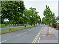
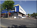
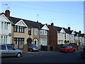
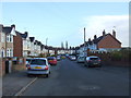
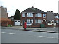
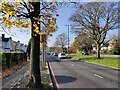
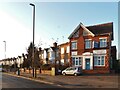
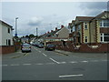

18 photos from this area
Area Information
Key information about the CV2 5FJ including its size, population, and administrative classification.
- Area Type
- Postcode
- Area Size
- 1.3 hectares
- Population
- 1688
- Population Density
- 6586 people/km²
House Prices in CV2 5FJ
32
Properties
£132,815
Average Sold Price
£48,950
Lowest Price
£287,000
Highest Price
Showing 32 properties
| Address | Type | Beds | Baths | Last Sale Price | Last Sale Date | |
|---|---|---|---|---|---|---|
| 112 Hipswell Highway, Coventry, CV2 5FJ | Flat | - | - | £125,400 | Feb 2024 | |
| 106 Hipswell Highway, Coventry, CV2 5FJ | Flat | - | - | £122,000 | Nov 2022 | |
| 138 Hipswell Highway, Coventry, CV2 5FJ | house | - | - | £150,000 | Jul 2022 | |
| 164 Hipswell Highway, Coventry, CV2 5FJ | house | 3 | 3 | £287,000 | May 2019 | |
| 154 Hipswell Highway, Coventry, CV2 5FJ | house | - | - | £195,500 | Aug 2018 | |
| 110 Hipswell Highway, Coventry, CV2 5FJ | Flat | - | - | £94,500 | Apr 2017 | |
| 156 Hipswell Highway, Coventry, CV2 5FJ | house | - | - | £200,000 | Sep 2016 | |
| 144 Hipswell Highway, Coventry, CV2 5FJ | Terraced | 3 | - | £115,000 | Mar 2014 | |
| 146 Hipswell Highway, Coventry, CV2 5FJ | house | 3 | - | £135,000 | Dec 2011 | |
| 166 Hipswell Highway, Coventry, CV2 5FJ | house | 3 | - | £107,000 | Sep 2011 |
Page 1 of 4
Energy Efficiency in CV2 5FJ
Amenities
Schools
| Rank | School | Type | Entry gender | Ages |
|---|
Explore more schools in this area
Go to Schools tabDemographics
Household Size
Family (3-5 people)
most common
Accommodation Type
Houses
most common
Tenure
76
majority
Ethnic Group
White
most common
Religion
N/A
most common
Household Composition
N/A
most common
Age
47
median
Adults (30-64 years)
most common
Household Deprivation
N/A
with no deprivation
NS-SEC
25
in Lower managerial occupations
Explore more demographic insights in this area
Go to Demographics tabPlanning
Planning Constraints
- Flood RiskPremium
- Ramsar Wetland SitesPremium
- Area of Outstanding Natural BeautyPremium
- Protected Nature ReservePremium
- Protected WoodlandPremium