Area Overview for CV2 4JZ
Photos of CV2 4JZ
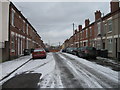
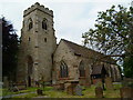
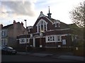
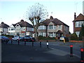
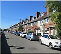
50 photos from this area
Area Information
Key information about the CV2 4JZ including its size, population, and administrative classification.
- Area Type
- Postcode
- Area Size
- 2.0 hectares
- Population
- 1731
- Population Density
- 6689 people/km²
House Prices in CV2 4JZ
44
Properties
£130,827
Average Sold Price
£39,500
Lowest Price
£235,000
Highest Price
Showing 44 properties
| Address | Type | Beds | Baths | Last Sale Price | Last Sale Date | |
|---|---|---|---|---|---|---|
| 16 Shakespeare Street, Coventry, CV2 4JZ | Terraced | 3 | 2 | £235,000 | Jul 2025 | |
| 44 Shakespeare Street, Coventry, CV2 4JZ | Terraced | 3 | 2 | £202,350 | Mar 2025 | |
| 72 Shakespeare Street, Coventry, CV2 4JZ | Terraced | 3 | 2 | £215,750 | Jun 2022 | |
| 30 Shakespeare Street, Coventry, CV2 4JZ | house | - | - | £167,000 | Oct 2020 | |
| 74 Shakespeare Street, Coventry, CV2 4JZ | house | - | - | £185,000 | Oct 2020 | |
| 14 Shakespeare Street, Coventry, CV2 4JZ | Terraced | 3 | 1 | £160,000 | Sep 2019 | |
| 18 Shakespeare Street, Coventry, CV2 4JZ | Terraced | 3 | 2 | £152,500 | Apr 2019 | |
| 66 Shakespeare Street, Coventry, CV2 4JZ | Terraced | 3 | 2 | £153,000 | May 2016 | |
| 10 Shakespeare Street, Coventry, CV2 4JZ | Terraced | 3 | 1 | £153,000 | Nov 2015 | |
| 60 Shakespeare Street, Coventry, CV2 4JZ | Land | - | - | £160,000 | Oct 2015 |
Page 1 of 5
Energy Efficiency in CV2 4JZ
Amenities
Schools
| Rank | School | Type | Entry gender | Ages |
|---|
Explore more schools in this area
Go to Schools tabDemographics
Household Size
Family (3-5 people)
most common
Accommodation Type
Houses
most common
Tenure
49
majority
Ethnic Group
White
most common
Religion
N/A
most common
Household Composition
N/A
most common
Age
47
median
Adults (30-64 years)
most common
Household Deprivation
N/A
with no deprivation
NS-SEC
20
in Lower managerial occupations
Explore more demographic insights in this area
Go to Demographics tabPlanning
Planning Constraints
- Flood RiskPremium
- Ramsar Wetland SitesPremium
- Area of Outstanding Natural BeautyPremium
- Protected Nature ReservePremium
- Protected WoodlandPremium