Area Overview for CV2 4JT
Photos of CV2 4JT
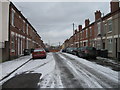
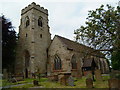

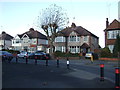
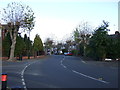
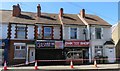
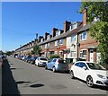
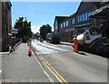
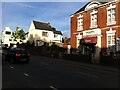
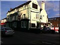
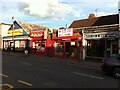

50 photos from this area
Area Information
Key information about the CV2 4JT including its size, population, and administrative classification.
- Area Type
- Postcode
- Area Size
- 2.5 hectares
- Population
- 1783
- Population Density
- 5379 people/km²
House Prices in CV2 4JT
30
Properties
£165,789
Average Sold Price
£96,000
Lowest Price
£261,000
Highest Price
Showing 30 properties
| Address | Type | Beds | Baths | Last Sale Price | Last Sale Date | |
|---|---|---|---|---|---|---|
| 101 Dane Road, Coventry, CV2 4JT | Terraced | 4 | 2 | £261,000 | Oct 2024 | |
| 89 Dane Road, Coventry, CV2 4JT | Retail | 3 | 1 | £170,000 | Dec 2022 | |
| 113 Dane Road, Coventry, CV2 4JT | Terraced | 3 | 1 | £235,000 | Mar 2022 | |
| 97 Dane Road, Coventry, CV2 4JT | Terraced | - | - | £215,000 | Nov 2021 | |
| 93 Dane Road, Coventry, CV2 4JT | Terraced | 4 | - | £245,000 | Aug 2021 | |
| 87 Dane Road, Coventry, CV2 4JT | house | - | - | £177,500 | Feb 2021 | |
| 79 Dane Road, Coventry, CV2 4JT | Terraced | 3 | 1 | £184,000 | Mar 2020 | |
| 107 Dane Road, Coventry, CV2 4JT | Terraced | 3 | 1 | £180,000 | Apr 2017 | |
| 95 Dane Road, Coventry, CV2 4JT | house | - | - | £138,000 | Oct 2015 | |
| 81 Dane Road, Coventry, CV2 4JT | Terraced | 3 | 1 | £135,000 | Jun 2015 |
Page 1 of 3
Energy Efficiency in CV2 4JT
Amenities
Schools
| Rank | School | Type | Entry gender | Ages |
|---|
Explore more schools in this area
Go to Schools tabDemographics
Household Size
Family (3-5 people)
most common
Accommodation Type
Houses
most common
Tenure
61
majority
Ethnic Group
White
most common
Religion
N/A
most common
Household Composition
N/A
most common
Age
47
median
Adults (30-64 years)
most common
Household Deprivation
N/A
with no deprivation
NS-SEC
24
in Lower managerial occupations
Explore more demographic insights in this area
Go to Demographics tabPlanning
Planning Constraints
- Flood RiskPremium
- Ramsar Wetland SitesPremium
- Area of Outstanding Natural BeautyPremium
- Protected Nature ReservePremium
- Protected WoodlandPremium