Area Overview for B97 6DU
Photos of B97 6DU
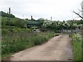
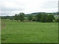
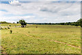
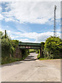

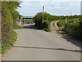
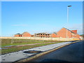
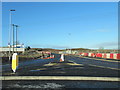
21 photos from this area
Area Information
Key information about the B97 6DU including its size, population, and administrative classification.
- Area Type
- Postcode
- Area Size
- 5383 m²
- Population
- 1533
- Population Density
- 2396 people/km²
House Prices in B97 6DU
8
Properties
£224,574
Average Sold Price
£151,766
Lowest Price
£260,978
Highest Price
Showing 8 properties
| Address | Type | Beds | Baths | Last Sale Price | Last Sale Date | |
|---|---|---|---|---|---|---|
| 6 Hawling Grove, Redditch, B97 6DU | house | - | - | £260,978 | Jun 2023 | |
| 10 Hawling Grove, Redditch, B97 6DU | Flat | - | - | £151,766 | Jun 2023 | |
| 14 Hawling Grove, Redditch, B97 6DU | house | - | - | £260,978 | Jun 2023 | |
| 2 Hawling Grove, Redditch, B97 6DU | Bungalow | - | - | - | - | |
| 12 Hawling Grove, Redditch, B97 6DU | Flat | - | - | - | - | |
| 8 Hawling Grove, Redditch, B97 6DU | house | - | - | - | - | |
| 4 Hawling Grove, Redditch, B97 6DU | Bungalow | - | - | - | - | |
| 16 Hawling Grove, Redditch, B97 6DU | house | - | - | - | - |
Energy Efficiency in B97 6DU
Amenities
Schools
| Rank | School | Type | Entry gender | Ages |
|---|
Explore more schools in this area
Go to Schools tabDemographics
Household Size
Family (3-5 people)
most common
Accommodation Type
Houses
most common
Tenure
78
majority
Ethnic Group
White
most common
Religion
N/A
most common
Household Composition
N/A
most common
Age
22
median
Adults (30-64 years)
most common
Household Deprivation
N/A
with no deprivation
NS-SEC
43
in Lower managerial occupations
Explore more demographic insights in this area
Go to Demographics tabPlanning
Planning Constraints
- Flood RiskPremium
- Ramsar Wetland SitesPremium
- Area of Outstanding Natural BeautyPremium
- Protected Nature ReservePremium
- Protected WoodlandPremium