Area Overview for B97 6DW
Photos of B97 6DW
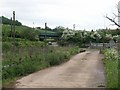
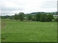
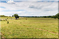
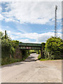
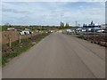
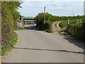
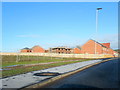
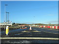
21 photos from this area
Area Information
Key information about the B97 6DW including its size, population, and administrative classification.
- Area Type
- Postcode
- Area Size
- 5.8 hectares
- Population
- 1533
- Population Density
- 2396 people/km²
House Prices in B97 6DW
72
Properties
£397,237
Average Sold Price
£146,000
Lowest Price
£1,159,194
Highest Price
Showing 72 properties
| Address | Type | Beds | Baths | Last Sale Price | Last Sale Date | |
|---|---|---|---|---|---|---|
| 26 Ossett Drive, Redditch, B97 6DW | Semi-detached | 3 | 1 | £146,000 | Mar 2025 | |
| 43 Ossett Drive, Cofton Hackett, Redditch, B97 6DW | Semi-detached | 3 | 2 | £259,554 | Dec 2024 | |
| 57 Ossett Drive, Cofton Hackett, Redditch, B97 6DW | house | - | - | £218,591 | Sep 2024 | |
| 59 Ossett Drive, Cofton Hackett, Redditch, B97 6DW | house | - | - | £218,591 | Sep 2024 | |
| 63 Ossett Drive, Cofton Hackett, Redditch, B97 6DW | house | - | - | £180,503 | Sep 2024 | |
| 61 Ossett Drive, Cofton Hackett, Redditch, B97 6DW | house | - | - | £180,503 | Sep 2024 | |
| 32 Ossett Drive, Redditch, B97 6DW | house | - | - | £899,914 | Jun 2023 | |
| 15 Ossett Drive, Redditch, B97 6DW | house | - | - | £300,000 | Jun 2023 | |
| 19 Ossett Drive, Redditch, B97 6DW | house | - | - | £437,182 | Jun 2023 | |
| 5 Ossett Drive, Redditch, B97 6DW | house | - | - | £350,000 | Mar 2023 |
Page 1 of 8
Energy Efficiency in B97 6DW
Amenities
Schools
| Rank | School | Type | Entry gender | Ages |
|---|
Explore more schools in this area
Go to Schools tabDemographics
Household Size
Family (3-5 people)
most common
Accommodation Type
Houses
most common
Tenure
78
majority
Ethnic Group
White
most common
Religion
N/A
most common
Household Composition
N/A
most common
Age
22
median
Adults (30-64 years)
most common
Household Deprivation
N/A
with no deprivation
NS-SEC
43
in Lower managerial occupations
Explore more demographic insights in this area
Go to Demographics tabPlanning
Planning Constraints
- Flood RiskPremium
- Ramsar Wetland SitesPremium
- Area of Outstanding Natural BeautyPremium
- Protected Nature ReservePremium
- Protected WoodlandPremium