Area Overview for B97 6RY
Photos of B97 6RY
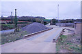
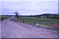

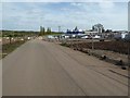
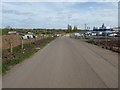
21 photos from this area
Area Information
Key information about the B97 6RY including its size, population, and administrative classification.
- Area Type
- Postcode
- Area Size
- 2.8 hectares
- Population
- 2806
- Population Density
- 1379 people/km²
House Prices in B97 6RY
77
Properties
£313,485
Average Sold Price
£96,000
Lowest Price
£492,958
Highest Price
Showing 77 properties
| Address | Type | Beds | Baths | Last Sale Price | Last Sale Date | |
|---|---|---|---|---|---|---|
| 47 Odell Street, Redditch, B97 6RY | Detached | 3 | 1 | £350,000 | Sep 2025 | |
| 61 Odell Street, Redditch, B97 6RY | Terraced | 3 | 2 | £162,000 | Jul 2025 | |
| 40 Odell Street, Redditch, B97 6RY | Detached | 3 | 1 | £340,000 | Mar 2025 | |
| 24 Odell Street, Redditch, B97 6RY | Detached | 4 | 1 | £365,000 | Aug 2024 | |
| 62 Odell Street, Redditch, B97 6RY | Semi-detached | 3 | 2 | £282,500 | Apr 2023 | |
| 12 Odell Street, Redditch, B97 6RY | Retail | 4 | 2 | £410,000 | Dec 2022 | |
| 44 Odell Street, Redditch, B97 6RY | Retail | 3 | 2 | £320,000 | Aug 2022 | |
| 16 Odell Street, Redditch, B97 6RY | Detached | 5 | 3 | £470,000 | Aug 2022 | |
| 58 Odell Street, Redditch, B97 6RY | house | - | - | £153,000 | Apr 2022 | |
| 60 Odell Street, Redditch, B97 6RY | house | - | - | £270,000 | Oct 2021 |
Page 1 of 8
Energy Efficiency in B97 6RY
Amenities
Schools
| Rank | School | Type | Entry gender | Ages |
|---|
Explore more schools in this area
Go to Schools tabDemographics
Household Size
Family (3-5 people)
most common
Accommodation Type
Houses
most common
Tenure
74
majority
Ethnic Group
White
most common
Religion
N/A
most common
Household Composition
N/A
most common
Age
47
median
Adults (30-64 years)
most common
Household Deprivation
N/A
with no deprivation
NS-SEC
35
in Lower managerial occupations
Explore more demographic insights in this area
Go to Demographics tabPlanning
Planning Constraints
- Flood RiskPremium
- Ramsar Wetland SitesPremium
- Area of Outstanding Natural BeautyPremium
- Protected Nature ReservePremium
- Protected WoodlandPremium