Area Overview for B93 9LS
Photos of B93 9LS
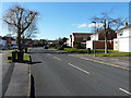
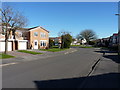
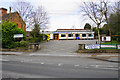
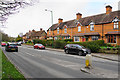
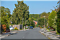
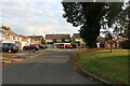
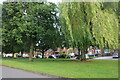
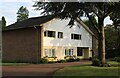
23 photos from this area
Area Information
Key information about the B93 9LS including its size, population, and administrative classification.
- Area Type
- Postcode
- Area Size
- 1.7 hectares
- Population
- 1658
- Population Density
- 592 people/km²
House Prices in B93 9LS
21
Properties
£508,114
Average Sold Price
£300,000
Lowest Price
£680,000
Highest Price
Showing 21 properties
| Address | Type | Beds | Baths | Last Sale Price | Last Sale Date | |
|---|---|---|---|---|---|---|
| 9 Lightwood Close, Knowle, Solihull, B93 9LS | Detached | 4 | 1 | £620,000 | Dec 2022 | |
| 2A Lightwood Close, Knowle, Solihull, B93 9LS | house | - | - | £632,500 | Nov 2021 | |
| 7 Lightwood Close, Knowle, Solihull, B93 9LS | Detached | 4 | - | £420,000 | Jan 2021 | |
| 10 Lightwood Close, Knowle, Solihull, B93 9LS | house | - | - | £680,000 | Jun 2020 | |
| 1 Lightwood Close, Knowle, Solihull, B93 9LS | Detached | 4 | - | £615,000 | Feb 2020 | |
| 4 Lightwood Close, Knowle, Solihull, B93 9LS | Bungalow | 3 | 2 | £565,000 | Jan 2020 | |
| 2 Lightwood Close, Knowle, Solihull, B93 9LS | Detached | 5 | 2 | £630,000 | Oct 2019 | |
| 14 Lightwood Close, Knowle, Solihull, B93 9LS | house | - | - | £560,000 | Oct 2018 | |
| 12 Lightwood Close, Knowle, Solihull, B93 9LS | house | - | - | £580,000 | Jan 2016 | |
| 18 Lightwood Close, Knowle, Solihull, B93 9LS | Detached | 3 | 2 | £345,100 | Jan 2013 |
Page 1 of 3
Energy Efficiency in B93 9LS
Amenities
Schools
| Rank | School | Type | Entry gender | Ages |
|---|
Explore more schools in this area
Go to Schools tabDemographics
Household Size
Two person
most common
Accommodation Type
Houses
most common
Tenure
88
majority
Ethnic Group
White
most common
Religion
N/A
most common
Household Composition
N/A
most common
Age
47
median
Elderly (65+ years)
most common
Household Deprivation
N/A
with no deprivation
NS-SEC
55
in Lower managerial occupations
Explore more demographic insights in this area
Go to Demographics tabPlanning
Planning Constraints
- Flood RiskPremium
- Ramsar Wetland SitesPremium
- Area of Outstanding Natural BeautyPremium
- Protected Nature ReservePremium
- Protected WoodlandPremium