Area Overview for B93 9AT
Photos of B93 9AT


Area Information
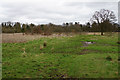
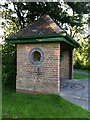
The postcode B93 9AT marks a specific residential cluster within the larger village of Knowle, situated five and a half hectares in size. This small settlement holds a population of 1,658 residents, forming a distinct community within the Metropolitan Borough of Solihull. You are living in an area that has evolved from a historic agricultural village into a established residential hub, positioned approximately five kilometres east-southeast of Solihull town centre. The location lies within the historic Arden area of Warwickshire, sitting mid-way between Birmingham and Warwick. Access to the area is provided by the A4141, which connects the village to both major cities. The landscape retains a sense of village atmosphere despite its growth over the last century. Daily life here centres on the retention of historic character alongside modern housing, particularly around the High Street conservation area. The cluster offers a quiet environment defined by its retention of landmarks like the 15th-century church and the Grand Union Canal. If you are considering homes in B93 9AT, you will find yourself in a stable, largely owner-occupied neighbourhood where the historic heritage is carefully preserved. The specific nature of this postcode ensures you are part of a tight-knit residential group rather than a sprawling urban neighbourhood.
- Area Type
- Postcode
- Area Size
- 5.5 hectares
- Population
- 1658
- Population Density
- 592 people/km²
The property market in B93 9AT is characterised by a proprietario model where 88% of the population owns their homes. This high ownership rate indicates a market dominated by owner-occupiers rather than a short-term rental sector. The accommodation type in this specific postcode is almost exclusively houses, which aligns with the village's evolution from a residential community in the 20th century. When you look at homes in B93 9AT, you will find stock that ranges from historic timber-framed buildings dating back to the 16th and 17th centuries to Victorian terraced cottages and villas. The area's snapshot as a small residential cluster of 5.5 hectares suggests a limited supply of new builds, reinforcing the value of existing period properties. The Conservation Area designation for the High Street and surrounding zones protects the character of the stock, ensuring that established homes retain their individual features. If you are looking for houses in this postcode, you will find a market where sellers are likely to be homeowners seeking to move rather than landlords. The stability of the market is further supported by the fact that the vast majority of the 1,658 residents have a long-term stake in their addresses. This makes the area attractive to buyers seeking a permanent home rather than a rental property.
House Prices in B93 9AT
Showing 15 properties
| Address | Type | Beds | Baths | Last Sale Price | Last Sale Date | |
|---|---|---|---|---|---|---|
| 19 Lady Byron Lane, Knowle, Solihull, B93 9AT | Detached | 4 | 4 | £3,044,000 | Dec 2023 | |
| 9 Lady Byron Lane, Knowle, Solihull, B93 9AT | Bungalow | 4 | 3 | £1,975,000 | Apr 2022 | |
| 37 Lady Byron Lane, Knowle, Solihull, B93 9AT | house | - | - | £1,260,000 | Feb 2021 | |
| 21 Lady Byron Lane, Knowle, Solihull, B93 9AT | Detached | - | - | £1,325,000 | Jan 2020 | |
| 17 Lady Byron Lane, Knowle, Solihull, B93 9AT | house | - | - | £1,350,000 | Jun 2017 | |
| 11 Lady Byron Lane, Knowle, Solihull, B93 9AT | house | - | - | £957,500 | Feb 2011 | |
| 15 Lady Byron Lane, Knowle, Solihull, B93 9AT | house | - | - | £1,000,000 | Aug 2007 | |
| 39 Lady Byron Lane, Knowle, Solihull, B93 9AT | house | - | - | £575,000 | Aug 2000 | |
| 23 Lady Byron Lane, Knowle, Solihull, B93 9AT | Detached | 5 | 4 | £475,000 | Apr 2000 | |
| Prestbury, 31 Lady Byron Lane, Knowle, Solihull, B93 9AT | Detached | - | - | - | - |
Energy Efficiency in B93 9AT
Living in B93 9AT provides easy access to a range of amenities that satisfy daily retail and travel needs without requiring a lengthy journey. Retail options are well provided by venues such as Tesco Knowle, Co-op Bentley, and Morrisons Solihull, ensuring you can find groceries and household essentials close to home. For larger shopping requirements, these specific stores offer a practical solution for weekly trips. Travel is further supported by proximity to five railway stations, including Widney Manor and Dorridge Railway Station, which simplify commuting. The area also offers significant convenience with two major airports nearby: Birmingham International Railway Station and Birmingham International Airport. These transport hubs are within practical reach of the residents, making flying simple for leisure or business. The Grand Union Canal with its flight of five locks serves as a local leisure facility, featuring a thriving boatyard and two pubs within walking distance. This blend of shopping centres and transport nodes creates a self-contained lifestyle. You can manage your daily errands and occasional holidays with minimal effort, all while enjoying the historic character of the High Street and the quiet residential streets of the cluster.
Amenities
Schools
| Rank | School | Type | Entry gender | Ages |
|---|
Explore more schools in this area
Go to Schools tabDemographics
The community in B93 9AT is defined by a mature demographic profile with a median age of 47 years. The most common age range among residents is the elderly population aged 65 years and over. This age structure suggests a neighbourhood populated by long-term homeowners and retirees rather than young families or students. Regarding housing tenure, an impressive 88% of the residents own their properties outright or with a mortgage, creating a heavily owner-occupied environment. The remaining households likely rent, but the dominant financial status is one of stability and long-term settlement. The accommodation type consists primarily of houses, indicating that flats or apartments are not the standard housing form in this specific cluster. The predominant ethnic group is White, reflecting the traditional settlement patterns of Knowle over the centuries. With a population density of 592 people per square kilometre, the area feels residential without being overcrowded. You are entering a community where the majority of people have deep roots in the area. The high rate of home ownership correlates with the presence of the 15th-century church and the conservation area, suggesting residents value stability and local assets.
Household Size
Accommodation Type
Tenure
Ethnic Group
Religion
Household Composition
Age
Household Deprivation
NS-SEC
Explore more demographic insights in this area
Go to Demographics tabPlanning
Planning Constraints
- Flood RiskPremium
- Ramsar Wetland SitesPremium
- Area of Outstanding Natural BeautyPremium
- Protected Nature ReservePremium
- Protected WoodlandPremium