Area Overview for B90 3LB
Photos of B90 3LB
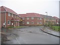
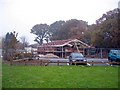
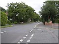
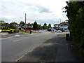
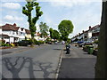
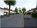
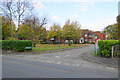
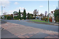
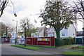
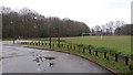
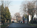
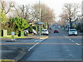
22 photos from this area
Area Information
Key information about the B90 3LB including its size, population, and administrative classification.
- Area Type
- Postcode
- Area Size
- 3.1 hectares
- Population
- 1485
- Population Density
- 3732 people/km²
House Prices in B90 3LB
36
Properties
£293,434
Average Sold Price
£149,950
Lowest Price
£420,000
Highest Price
Showing 36 properties
| Address | Type | Beds | Baths | Last Sale Price | Last Sale Date | |
|---|---|---|---|---|---|---|
| 189 Ralph Road, Shirley, Solihull, B90 3LB | house | - | - | £385,000 | Apr 2023 | |
| 195 Ralph Road, Shirley, Solihull, B90 3LB | house | - | - | £410,000 | Oct 2021 | |
| 193 Ralph Road, Shirley, Solihull, B90 3LB | house | - | - | £326,500 | Mar 2021 | |
| 200 Ralph Road, Shirley, Solihull, B90 3LB | Semi-detached | 3 | 1 | £375,000 | Nov 2020 | |
| 191 Ralph Road, Shirley, Solihull, B90 3LB | Semi-detached | 4 | 2 | £420,000 | Aug 2019 | |
| 198 Ralph Road, Shirley, Solihull, B90 3LB | house | - | - | £185,000 | Jun 2019 | |
| 182 Ralph Road, Shirley, Solihull, B90 3LB | Semi-detached | 4 | 1 | £410,000 | Mar 2019 | |
| 190 Ralph Road, Shirley, Solihull, B90 3LB | Semi-detached | 3 | 2 | £365,000 | Jan 2017 | |
| 192 Ralph Road, Shirley, Solihull, B90 3LB | Semi-detached | 3 | 1 | £300,000 | Dec 2016 | |
| 188 Ralph Road, Shirley, Solihull, B90 3LB | house | 3 | - | £310,000 | Aug 2016 |
Page 1 of 4
Energy Efficiency in B90 3LB
Amenities
Schools
| Rank | School | Type | Entry gender | Ages |
|---|
Explore more schools in this area
Go to Schools tabDemographics
Household Size
Family (3-5 people)
most common
Accommodation Type
Houses
most common
Tenure
87
majority
Ethnic Group
White
most common
Religion
N/A
most common
Household Composition
N/A
most common
Age
47
median
Adults (30-64 years)
most common
Household Deprivation
N/A
with no deprivation
NS-SEC
47
in Lower managerial occupations
Explore more demographic insights in this area
Go to Demographics tabPlanning
Planning Constraints
- Flood RiskPremium
- Ramsar Wetland SitesPremium
- Area of Outstanding Natural BeautyPremium
- Protected Nature ReservePremium
- Protected WoodlandPremium