Area Overview for B90 3JQ
Photos of B90 3JQ
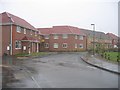
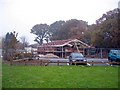
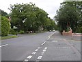
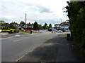
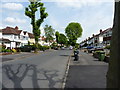
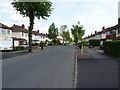
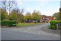
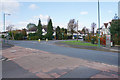

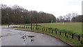


22 photos from this area
Area Information
Key information about the B90 3JQ including its size, population, and administrative classification.
- Area Type
- Postcode
- Area Size
- 1.7 hectares
- Population
- 1927
- Population Density
- 4964 people/km²
House Prices in B90 3JQ
34
Properties
£294,713
Average Sold Price
£79,000
Lowest Price
£485,000
Highest Price
Showing 34 properties
| Address | Type | Beds | Baths | Last Sale Price | Last Sale Date | |
|---|---|---|---|---|---|---|
| 105 Stanway Road, Shirley, Solihull, B90 3JQ | Semi-detached | 1 | 2 | £359,950 | Jun 2024 | |
| 151 Stanway Road, Shirley, Solihull, B90 3JQ | Semi-detached | 3 | 1 | £453,000 | Mar 2024 | |
| 119 Stanway Road, Shirley, Solihull, B90 3JQ | house | - | - | £420,000 | Nov 2023 | |
| 137 Stanway Road, Shirley, Solihull, B90 3JQ | Semi-detached | 3 | 1 | £485,000 | Aug 2023 | |
| 169 Stanway Road, Shirley, Solihull, B90 3JQ | Semi-detached | 5 | - | £444,950 | Nov 2021 | |
| 131 Stanway Road, Shirley, Solihull, B90 3JQ | Semi-detached | 3 | 1 | £348,000 | May 2021 | |
| 161 Stanway Road, Shirley, Solihull, B90 3JQ | house | - | - | £392,500 | Dec 2020 | |
| 163 Stanway Road, Shirley, Solihull, B90 3JQ | Semi-detached | 4 | 2 | £385,000 | Aug 2020 | |
| 115 Stanway Road, Shirley, Solihull, B90 3JQ | Semi-detached | 4 | 1 | £360,000 | Feb 2019 | |
| 117 Stanway Road, Shirley, Solihull, B90 3JQ | Semi-detached | 5 | 1 | £344,000 | Oct 2018 |
Page 1 of 4
Energy Efficiency in B90 3JQ
Amenities
Schools
| Rank | School | Type | Entry gender | Ages |
|---|
Explore more schools in this area
Go to Schools tabDemographics
Household Size
Family (3-5 people)
most common
Accommodation Type
Houses
most common
Tenure
90
majority
Ethnic Group
White
most common
Religion
N/A
most common
Household Composition
N/A
most common
Age
47
median
Adults (30-64 years)
most common
Household Deprivation
N/A
with no deprivation
NS-SEC
45
in Lower managerial occupations
Explore more demographic insights in this area
Go to Demographics tabPlanning
Planning Constraints
- Flood RiskPremium
- Ramsar Wetland SitesPremium
- Area of Outstanding Natural BeautyPremium
- Protected Nature ReservePremium
- Protected WoodlandPremium