Area Overview for B90 2RB
Photos of B90 2RB
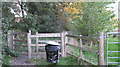
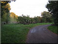
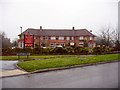
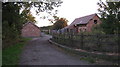
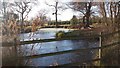


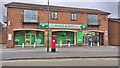
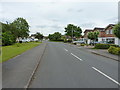
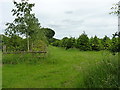
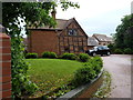
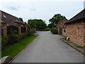
27 photos from this area
Area Information
Key information about the B90 2RB including its size, population, and administrative classification.
- Area Type
- Postcode
- Area Size
- 4.4 hectares
- Population
- 1529
- Population Density
- 2905 people/km²
House Prices in B90 2RB
67
Properties
£285,099
Average Sold Price
£51,000
Lowest Price
£626,000
Highest Price
Showing 67 properties
| Address | Type | Beds | Baths | Last Sale Price | Last Sale Date | |
|---|---|---|---|---|---|---|
| 74 Binley Close, Shirley, Solihull, B90 2RB | house | - | - | £533,000 | Sep 2025 | |
| 48 Binley Close, Shirley, Solihull, B90 2RB | Maisonette | 2 | 1 | £235,000 | Oct 2023 | |
| 22 Binley Close, Shirley, Solihull, B90 2RB | Semi-detached | 3 | 1 | £340,000 | Jun 2023 | |
| 11 Binley Close, Shirley, Solihull, B90 2RB | Semi-detached | 4 | 2 | £416,000 | May 2023 | |
| 32 Binley Close, Shirley, Solihull, B90 2RB | Maisonette | 2 | 1 | £218,000 | May 2023 | |
| 23 Binley Close, Shirley, Solihull, B90 2RB | Semi-detached | 3 | 1 | £330,000 | Apr 2023 | |
| 20 Binley Close, Shirley, Solihull, B90 2RB | Semi-detached | 3 | 1 | £410,000 | Dec 2022 | |
| 69 Binley Close, Shirley, Solihull, B90 2RB | house | 4 | - | £485,000 | Sep 2022 | |
| 1 Binley Close, Shirley, Solihull, B90 2RB | Detached | 4 | 2 | £626,000 | Sep 2022 | |
| 57 Binley Close, Shirley, Solihull, B90 2RB | house | - | - | £470,000 | Apr 2022 |
Page 1 of 7
Energy Efficiency in B90 2RB
Amenities
Schools
| Rank | School | Type | Entry gender | Ages |
|---|
Explore more schools in this area
Go to Schools tabDemographics
Household Size
Two person
most common
Accommodation Type
Houses
most common
Tenure
94
majority
Ethnic Group
White
most common
Religion
N/A
most common
Household Composition
N/A
most common
Age
47
median
Adults (30-64 years)
most common
Household Deprivation
N/A
with no deprivation
NS-SEC
45
in Lower managerial occupations
Explore more demographic insights in this area
Go to Demographics tabPlanning
Planning Constraints
- Flood RiskPremium
- Ramsar Wetland SitesPremium
- Area of Outstanding Natural BeautyPremium
- Protected Nature ReservePremium
- Protected WoodlandPremium