Area Overview for B90 2ST
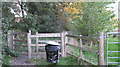
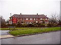
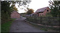
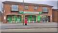
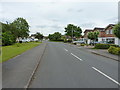
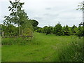
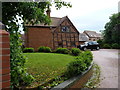
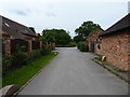
Photos of B90 2ST


Area Information
Living in B90 2ST means being part of a tightly knit residential cluster in the Shirley area of Solihull, West Midlands. With a population of 1,529, this small postcode area reflects a suburban character shaped by its history as a rural settlement that expanded into a modern residential hub. The area is bisected by Stratford Road, a historic route that once served as a turnpike, and is now a key artery linking to nearby towns. Residents benefit from proximity to commercial and retail centres, including Sainsburys and M&S, while the surrounding region hosts major infrastructure like Birmingham International Airport. The mix of urban and residential elements, combined with low crime rates and excellent broadband connectivity, makes B90 2ST appealing for families and professionals seeking stability. Its location within Solihull’s broader network ensures access to transport links, schools, and amenities without the congestion of larger cities. The area’s compact size and well-defined boundaries create a sense of community, though its small scale means residents must look slightly beyond the postcode for broader services.
- Area Type
- Postcode
- Area Size
- Not available
- Population
- 1529
- Population Density
- 2905 people/km²
The property market in B90 2ST is characterised by high home ownership (94%) and a predominance of houses over flats or apartments. This suggests a suburban, family-oriented area where properties are likely to be larger and more traditional in design. The high ownership rate indicates limited rental activity, meaning the market is primarily driven by owner-occupiers rather than investors. For buyers, this presents both opportunities and challenges: the limited number of properties for sale or rent may reduce competition but also restrict choices. The focus on houses implies that the area caters to those requiring more space, such as growing families or professionals seeking a quieter lifestyle. However, the small size of the postcode area means that buyers may need to consider nearby suburbs or larger parts of Solihull for more options. The stability of the market, combined with low crime and good connectivity, could make it an attractive long-term investment for those prioritising security and convenience.
House Prices in B90 2ST
No properties found in this postcode.
Energy Efficiency in B90 2ST
The lifestyle in B90 2ST is shaped by its proximity to a range of amenities, from retail to transport hubs. Residents can access major supermarkets like Sainsburys Solihull Haslucks and M&S Stratford Rd, ensuring convenience for shopping and daily essentials. The area’s rail network includes stations such as Shirley and Wythall, connecting to Birmingham International Airport and central London via metro links like Grand Central New Street. While the data does not specify parks or leisure facilities, the surrounding region includes Marshall Lake park and retail centres, suggesting opportunities for recreation and socialising. The mix of retail, transport, and commercial infrastructure supports a practical, commuter-friendly lifestyle. The area’s character is defined by its suburban tranquillity, balanced with access to urban amenities, making it suitable for those who value convenience without sacrificing a sense of community.
Amenities
Schools
Residents of B90 2ST have access to two notable schools. Light Hall School Specialist Mathematics and Computing College is a primary school, offering a focused curriculum in mathematics and computing. Nearby, Light Hall School is an academy with a good Ofsted rating, providing secondary education. The presence of both a primary school and an academy suggests a range of educational options for families, from early years to secondary education. The good Ofsted rating at Light Hall School indicates a reliable standard of teaching and facilities, which is a key consideration for parents. While the data does not specify catchment areas or student performance, the combination of specialist and general education institutions may cater to diverse academic needs. Families seeking schools with a strong emphasis on STEM subjects or broader academic development will find the options in B90 2ST aligned with these priorities.
| Rank | School | Type | Entry gender | Ages |
|---|
Explore more schools in this area
Go to Schools tabDemographics
The population of B90 2ST is predominantly adults aged 30–64, with a median age of 47. This suggests a mature, settled community, likely comprising professionals and families with established careers. Home ownership is exceptionally high at 94%, indicating a strong preference for long-term residency over rental properties. The accommodation type is primarily houses, reflecting a suburban layout rather than high-density housing. The predominant ethnic group is White, which aligns with broader demographic trends in Solihull. The absence of specific data on deprivation or diversity means the area’s social dynamics are not explicitly detailed, but the high home ownership and age profile imply a relatively stable, low-turnover population. This demographic profile may appeal to buyers seeking a quiet, family-friendly environment with minimal turnover and a focus on long-term living.
Household Size
Accommodation Type
Tenure
Ethnic Group
Religion
Household Composition
Age
Household Deprivation
NS-SEC
Explore more demographic insights in this area
Go to Demographics tabPlanning
Planning Constraints
- Flood RiskPremium
- Ramsar Wetland SitesPremium
- Area of Outstanding Natural BeautyPremium
- Protected Nature ReservePremium
- Protected WoodlandPremium