Area Overview for B90 2SZ
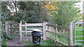
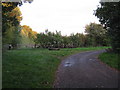
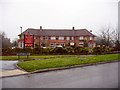
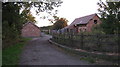
Photos of B90 2SZ


Area Information
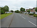
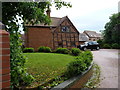
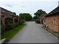
Living in B90 2SZ means being part of a compact residential cluster within Shirley, a suburb of Solihull. With a population of 1,529, this area blends urban convenience with historical roots, once a rural settlement in Warwickshire. The Stratford Road, a key thoroughfare, bisects the ward, linking it to broader Solihull networks. Daily life here is shaped by its proximity to commercial hubs, including distribution centres and retail parks like Marshall Lake, which offer a mix of shopping and leisure. The area’s character is defined by its mix of residential and workplace environments, with more jobs located within the district than resident workers. This creates a dynamic but tightly knit community, where historic landmarks like St James’ Church (1832) sit alongside modern amenities. For buyers, B90 2SZ offers a balance of stability and accessibility, with rail links to Birmingham and nearby motorways ensuring easy travel. Its small size means a focused, manageable area to explore, ideal for those seeking a quieter, well-connected suburb without the chaos of larger cities.
- Area Type
- Postcode
- Area Size
- Not available
- Population
- 1529
- Population Density
- 2905 people/km²
The property market in B90 2SZ is dominated by owner-occupied homes, with 94% of residents living in properties they own. This high home ownership rate indicates a stable, long-term market with limited rental activity. The accommodation type is primarily houses, which is unusual for areas with higher flat or apartment densities. This suggests a focus on family-friendly, spacious homes, possibly appealing to those seeking a traditional suburban layout. The small size of the postcode area means the housing stock is likely limited in scale, with properties concentrated in a defined cluster. For buyers, this presents a niche opportunity: a compact, well-established area with strong ownership rates, potentially offering good value for those prioritising security and a settled community. However, the limited number of properties may also mean fewer options for buyers, requiring a targeted search within the immediate vicinity.
House Prices in B90 2SZ
No properties found in this postcode.
Energy Efficiency in B90 2SZ
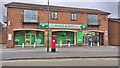
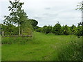
Life in B90 2SZ is enriched by a range of amenities within easy reach. Retail options include Sainsburys Solihull Haslucks and M&S Stratford Rd, offering everyday shopping needs. The area’s proximity to Marshall Lake park provides green space for leisure, while historic sites like Shirley Street and St James’ Church add cultural depth. The Stratford Road, once a turnpike, remains a central thoroughfare, linking residents to broader networks. Nearby rail stations and the Birmingham International Airport ensure convenient travel, while the presence of distribution hubs and commercial offices reflects the area’s economic vibrancy. This blend of practicality and character creates a lifestyle that balances convenience with a sense of place, ideal for those who value both accessibility and a touch of history in their daily lives.
Amenities
Schools
Residents of B90 2SZ have access to two notable schools. Light Hall School Specialist Mathematics and Computing College is a primary school, offering a focused curriculum in STEM subjects. Nearby, Light Hall School is an academy with a good Ofsted rating, providing a broader secondary education. The presence of both a specialist primary and a rated secondary academy offers families a seamless educational pathway. The mix of school types suggests a commitment to academic excellence, particularly in mathematics and computing, which may appeal to parents seeking structured, high-quality education. These schools are likely to be central to the area’s community life, drawing families to the suburb. The proximity of these institutions to residential properties underscores B90 2SZ’s appeal as a family-friendly location.
| Rank | School | Type | Entry gender | Ages |
|---|
Explore more schools in this area
Go to Schools tabDemographics
The residents of B90 2SZ are predominantly adults aged 30–64, with a median age of 47. This suggests a mature, established community, likely with strong family ties and a focus on long-term residency. Home ownership is exceptionally high at 94%, indicating a stable housing market where most properties are owner-occupied rather than rented. The area’s accommodation is primarily houses, reflecting a preference for single-family homes over flats. The predominant ethnic group is White, though no specific diversity metrics are provided. The high home ownership rate and age profile suggest a population prioritising security and continuity, with fewer transient residents. This demographic profile aligns with the area’s character as a settled, suburban environment where property values are likely to remain steady. The absence of detailed deprivation data means the quality of life here appears to be supported by infrastructure and services, though further local insights would clarify this.
Household Size
Accommodation Type
Tenure
Ethnic Group
Religion
Household Composition
Age
Household Deprivation
NS-SEC
Explore more demographic insights in this area
Go to Demographics tabPlanning
Planning Constraints
- Flood RiskPremium
- Ramsar Wetland SitesPremium
- Area of Outstanding Natural BeautyPremium
- Protected Nature ReservePremium
- Protected WoodlandPremium