Area Overview for B80 7SL
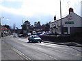
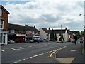
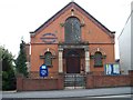
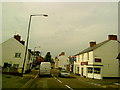
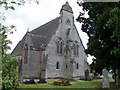
Photos of B80 7SL
Area Information
The postcode B80 7SL defines a specific residential cluster within the larger settlement of Studley, Warwickshire. This location encompasses 1,655 residents across an area size of 1244 square metres, resulting in a population density of 249 people per square kilometre. You are living in a large village and civil parish situated on the western edge of the county, just 3.5 miles from Redditch and 13 miles from Stratford-upon-Avon. The A435, historically known as Roman Ryknild Street, passes through the eastern edge of the area, running parallel to the River Arrow. Daily life for residents combines deep historical roots with accessible modern infrastructure. Studley was first mentioned in 1005 and recorded in the Domesday Book, with significant local heritage including the remains of a medieval castle and a Dissolved Augustinian priory. These sites sit alongside contemporary educational institutions and sports clubs. The area functions as a practical hub for those working in the broader midlands region. Homes in B80 7SL sit within an environment free from major planning constraints like protected woodlands or Areas of Outstanding Natural Beauty. The limited administrative footprint of the postcode means you are embedded in a distinct residential zone rather than a sprawling suburb. The 249 people per square kilometre figure indicates a compact community where local amenities are within easy reach. Living here offers a blend of historical character and functional connectivity to major roads. You inhabit an area where the A435 provides a direct link to Alcester and Birmingham. The demographic profile of this cluster suggests a family-oriented environment where neighbours know one another. The postcode serves as a precise identifier for this specific residential cluster, distinguishing it from the wider parish boundaries. Local life revolves around the proximity of schools, shops, and historic landmarks.
- Area Type
- Postcode
- Area Size
- 1244 m²
- Population
- 1655
- Population Density
- 249 people/km²
The property market in B80 7SL is characterised by a significant preference for ownership over renting. With 75 per cent of homes in the area owned outright, this postcode represents a settled market where residents build equity rather than paying rent. The predominant accommodation type is houses, which fits the profile of the large village environment. This high ownership percentage indicates that the built environment caters to families and individuals seeking long-term stability in their residence. Homes in B80 7SL are primarily single-detached or semi-detached properties rather than flats or apartments. The accommodation type data confirms that you will find traditional housing stock, likely with gardens and driveways given the single-storey or two-storey layout typical of Warwickshire. The fact that three-quarters of residents own their homes suggests a lack of transient rental blocks, which often cluster in student areas or urban regeneration zones. This market dynamic means that when buying or selling within the B80 7SL postcode, you interact mostly with other homeowners. The 1,655 residents spread across the small area size of 1244 square metres imply a high concentration of residential units, though the high ownership rate filters out the rental sector. Properties here are likely valued for their character and space rather than rental yield potential. A buyer focusing on this area targets a neighbourhood where people have put down roots. The high ownership rate often correlates with better-maintained properties and a engaged community looking after local streetscapes. The housing stock reflects the established nature of the village, avoiding the construction of modern build developments typical of new housing estates. You are entering a market driven by personal choice and investment rather than speculative housing development.
House Prices in B80 7SL
Showing 15 properties
| Address | Type | Beds | Baths | Last Sale Price | Last Sale Date | |
|---|---|---|---|---|---|---|
| 12, Marlborough Mews, Alcester Road, Studley, B80 7SL | Flat | - | - | £143,000 | Feb 2024 | |
| 9, Marlborough Mews, Alcester Road, Studley, B80 7SL | Flat | - | - | £145,000 | Oct 2023 | |
| 15, Marlborough Mews, Alcester Road, Studley, B80 7SL | Flat | 2 | 1 | £145,000 | Jun 2022 | |
| 1, Marlborough Mews, Alcester Road, Studley, B80 7SL | Flat | - | - | £31,500 | Jun 2021 | |
| 10, Marlborough Mews, Alcester Road, Studley, B80 7SL | Flat | 2 | 1 | £139,000 | Nov 2020 | |
| 16, Marlborough Mews, Alcester Road, Studley, B80 7SL | Flat | - | - | £138,000 | Jul 2019 | |
| 5, Marlborough Mews, Alcester Road, Studley, B80 7SL | Flat | - | - | £135,000 | May 2019 | |
| 3, Marlborough Mews, Alcester Road, Studley, B80 7SL | Flat | 2 | 1 | £124,000 | Oct 2017 | |
| 14, Marlborough Mews, Alcester Road, Studley, B80 7SL | Flat | - | - | £119,000 | Feb 2014 | |
| 6, Marlborough Mews, Alcester Road, Studley, B80 7SL | Flat | 2 | 1 | £111,500 | Feb 2011 |
Energy Efficiency in B80 7SL
Residents of B80 7SL enjoy a variety of amenities within practical reach of daily life. The local retail scene includes Co-op Studley, Aldi Studley, and Spar, ensuring you can complete all grocery and household shopping needs without leaving the village. With five notable retail options identified, the area avoids the need to drive long distances for essentials. These venues are clustered to serve the community of 1,655 people effectively. Transport links also feed directly into your lifestyle, with five notable railway stations including Redditch Railway Station, Wootton Wawen Railway Station, and Danzey Railway Station. These connections complement the A435 road access, allowing you to travel by train or car depending on your preference. The presence of these stations in the immediate vicinity broadens the range of towns and cities you can access for leisure or work. The historical and natural character of Studley provides a distinct lifestyle backdrop. Sites like the medieval castle and the Augustinian priory add depth to the local walks and heritage tours. You can explore the historic needle-making sites on heritage walks, which offer insights into the local economy from the 17th century. The proximity to the A435 allows for quick trips to Birmingham, while the village itself offers a quieter retreat. Living in B80 7SL provides a balance between village tranquility and commercial convenience. Shops like Co-op and Aldi ensure your week is manageable and routine. The transport network supports both local errands and long-distance travel. The amenities listed in the data cover both the immediate shopping needs and the broader travel requirements of daily life.
Amenities
Schools
Families living in B80 7SL have access to a comprehensive range of educational institutions within the Studley area. The local landscape includes Studley Community Infants' School, which serves the younger population from reception class age. Nearby, Studley St Mary's CofE Junior School provides education for pupils transitioning into middle years. For Catholic families, St Mary's Catholic Primary School, Studley offers specific religious education alongside the standard curriculum. Academic performance indicators show that Studley St Mary's CofE Academy holds a good Ofsted rating, providing a quality secondary or specialist academy option for older children. Another sector, the academy type, is represented by Studley Infants' School, which also operates under this independent framework. This mix ensures that children in the area can attend schools with varying specialisms, from faith-based education to community-led academies. The presence of multiple primary schools and one academy indicates a diversified choice for parents. Living in this area puts you within the catchment zones of these specific institutions. You can choose between the community setting of Studley Community Infants' School or the faith-based environment of St Mary's Catholic Primary School. The Academies, including Studley St Mary's CofE Academy, offer a structured educational environment with rated standards. Schools near B80 7SL are all located within the immediate vicinity, making the commute minimal for families. The combination of infant, junior, and academy schools supports children from early years through to primary completion. This concentration of educational provision reflects the village's commitment to supporting local families without relying solely on facilities in larger towns.
| Rank | School | Type | Entry gender | Ages |
|---|
Explore more schools in this area
Go to Schools tabDemographics
The community in B80 7SL is defined by a stable and mature population structure. The median age stands at 47 years, with the most common age range being adults between 30 and 64 years old. This concentration indicates that the neighbourhood attracts families in their prime earning years and empty nesters. The demographic profile reflects a settled population rather than one dominated by students or young professionals. Home ownership levels in this area reach 75 per cent, establishing it as a distinct owner-occupied community rather than a rental market. This high percentage suggests that residents have long-term stakes in the locality and value stability. The prevailing accommodation type consists of houses, which aligns with the preference of the average household in Studley for detached or semi-detached family homes. The 1655 residents are predominantly from a White ethnic group, reflecting a traditional demographic composition common in established Warwickshire villages. The population density of 249 people per square kilometre creates a relatively low-density living environment compared to major urban centres. You will find that the area caters to those seeking quiet streets and private gardens rather than high-rise flats or terraced housing blocks. The 75 per cent ownership rate means that most transactions involve existing homeowners rather than landlords seeking to rent to tenants. Living in B80 7SL offers a sense of belonging within a community where the majority of residents have built a life locally. The age profile supports local schools and family services, as parents remain in the area for their children's education. The lack of high-density housing maintains the rural character of the village despite its proximity to transport links. The demographic split between the 30-64 age group and the overall median age of 47 highlights a consistent life stage across the neighbourhood.
Household Size
Accommodation Type
Tenure
Ethnic Group
Religion
Household Composition
Age
Household Deprivation
NS-SEC
Explore more demographic insights in this area
Go to Demographics tabPlanning
Planning Constraints
- Flood RiskPremium
- Ramsar Wetland SitesPremium
- Area of Outstanding Natural BeautyPremium
- Protected Nature ReservePremium
- Protected WoodlandPremium