Area Overview for B80 7LL
Photos of B80 7LL
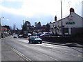
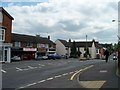
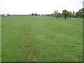
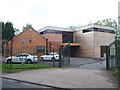

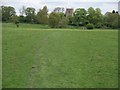
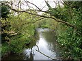
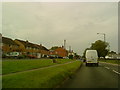
55 photos from this area
Area Information
Key information about the B80 7LL including its size, population, and administrative classification.
- Area Type
- Postcode
- Area Size
- 3225 m²
- Population
- 1655
- Population Density
- 249 people/km²
House Prices in B80 7LL
10
Properties
£188,000
Average Sold Price
£188,000
Lowest Price
£188,000
Highest Price
Showing 10 properties
| Address | Type | Beds | Baths | Last Sale Price | Last Sale Date | |
|---|---|---|---|---|---|---|
| 25B Alcester Road, Studley, B80 7LL | Retail | 2 | 1 | £188,000 | Feb 2018 | |
| 27A Alcester Road, Studley, B80 7LL | Flat | 2 | 1 | - | - | |
| Flat, 33-35 Alcester Road, Studley, B80 7LL | Flat | 2 | 1 | - | - | |
| Tesco Express, 33-35 Alcester Road, Studley, B80 7LL | retail_financial | - | - | - | - | |
| Kwarn Thai Restaurant, Mount Everest Restaurant, 31 Alcester Road, Studley, B80 7LL | Retail | - | - | - | - | |
| 31A Alcester Road, Studley, B80 7LL | Flat | - | - | - | - | |
| First Floor Office 5, The Grange, 37 Alcester Road, Studley, B80 7LL | Office | - | - | - | - | |
| Ground Floor Office 2, The Grange, 37 Alcester Road, Studley, B80 7LL | Office | - | - | - | - | |
| First Floor Office 4, The Grange, 37 Alcester Road, Studley, B80 7LL | Office | - | - | - | - | |
| 37A Alcester Road, Studley, B80 7LL | Office | - | - | - | - |
Energy Efficiency in B80 7LL
Amenities
Schools
| Rank | School | Type | Entry gender | Ages |
|---|
Explore more schools in this area
Go to Schools tabDemographics
Household Size
Two person
most common
Accommodation Type
Houses
most common
Tenure
75
majority
Ethnic Group
White
most common
Religion
N/A
most common
Household Composition
N/A
most common
Age
47
median
Adults (30-64 years)
most common
Household Deprivation
N/A
with no deprivation
NS-SEC
38
in Lower managerial occupations
Explore more demographic insights in this area
Go to Demographics tabPlanning
Planning Constraints
- Flood RiskPremium
- Ramsar Wetland SitesPremium
- Area of Outstanding Natural BeautyPremium
- Protected Nature ReservePremium
- Protected WoodlandPremium