Area Overview for B79 7TH
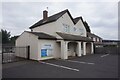
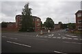
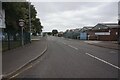
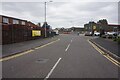
Photos of B79 7TH


Area Information
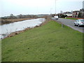
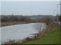
B79 7TH is a small, tightly packed residential postcode area within Tamworth, a historic town in Staffordshire. Situated in the Mercian Ward, it lies near the River Tame, one of the defining geographical features of the region. With a population of 1,333 spread across just 6,729 square metres, the area has an exceptionally high population density of 198,095 people per square kilometre. This compactness means the community is closely knit, with daily life shaped by proximity to local amenities and historical landmarks. Tamworth itself is steeped in Anglo-Saxon heritage, having been the capital of the Kingdom of Mercia in the 8th century. The area’s modern identity blends this ancient past with practical living, offering residents a mix of traditional housing and contemporary infrastructure. Despite its size, B79 7TH is well-connected to nearby rail stations and bus routes, ensuring access to broader regional networks. Its small footprint means the area feels intimate, with a focus on local needs rather than sprawling development. For those seeking a quiet, historically rich environment with strong community ties, B79 7TH presents a distinct contrast to larger urban centres.
- Area Type
- Postcode
- Area Size
- 6729 m²
- Population
- 1333
- Population Density
- 2170 people/km²
The property market in B79 7TH is dominated by houses, with 51% of residents owning their homes. This suggests a stable, owner-occupied market rather than a rental-heavy area. The prevalence of houses over flats indicates a focus on family homes or larger properties, which may appeal to buyers seeking space and privacy. Given the area’s small size and high population density, the housing stock is likely limited, with little scope for new developments. This could make the market competitive for buyers, particularly those looking for properties with specific features. The compact nature of B79 7TH also means that proximity to local amenities is a key selling point. For those considering the area, the mix of historical charm and practical living conditions may be a draw, though the limited property supply could mean longer search times or higher prices compared to surrounding regions.
House Prices in B79 7TH
No properties found in this postcode.
Energy Efficiency in B79 7TH
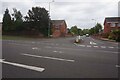
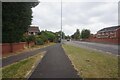
Living in B79 7TH offers access to a range of practical amenities within close reach. The area includes five retail outlets, such as Spar, Tamworth Co-operative Society Co, and Co-op Leyfields, providing essential shopping options. The Victoria Road Bus Interchange ensures convenient public transport links, while five nearby railway stations—Tamworth High Level, Wilnecote, and Polesworth—connect residents to broader regional networks. These stations are particularly useful for commuters seeking to travel to nearby towns or cities. The presence of multiple retail and transport options suggests a lifestyle that balances local convenience with the ability to access wider opportunities. While the area lacks large-scale leisure facilities, its compact nature means residents can easily access nearby attractions in Tamworth, such as historical sites or natural spaces along the River Tame.
Amenities
Schools
| Rank | School | Type | Entry gender | Ages |
|---|
Explore more schools in this area
Go to Schools tabDemographics
The population of B79 7TH is predominantly middle-aged, with a median age of 47 and the most common age range being adults aged 30–64. This suggests a community focused on stability, with many residents likely in their prime working years. Home ownership rates are 51%, indicating a balance between owner-occupied properties and rental homes. The area is characterised by houses rather than flats, reflecting a preference for single-family dwellings. The predominant ethnic group is White, though specific data on diversity is not provided. The high proportion of adult residents and the prevalence of owner-occupied homes suggest a mature, settled community. However, the lack of detailed information on income levels or deprivation means it is difficult to assess broader quality-of-life factors beyond what is explicitly stated. The data underscores a demographic profile that prioritises long-term residence and family-oriented living.
Household Size
Accommodation Type
Tenure
Ethnic Group
Religion
Household Composition
Age
Household Deprivation
NS-SEC
Explore more demographic insights in this area
Go to Demographics tabPlanning
Planning Constraints
- Flood RiskPremium
- Ramsar Wetland SitesPremium
- Area of Outstanding Natural BeautyPremium
- Protected Nature ReservePremium
- Protected WoodlandPremium