Area Overview for B79 7TN
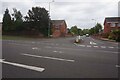
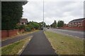
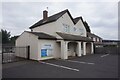
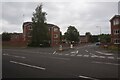
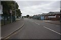
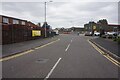
Photos of B79 7TN


Area Information
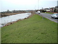
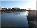
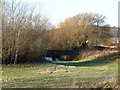
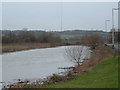
Living in B79 7TN means being part of a small, tightly knit residential cluster within the historic town of Tamworth, a place shaped by its Anglo-Saxon roots and the River Tame. With a population of 1,333, this area is compact yet rich in heritage, sitting within the Mercian Ward electoral district. Daily life here is influenced by Tamworth’s status as a former Mercian capital and its modern role as a borough in Staffordshire. Residents benefit from proximity to the town’s core, where the rivers Tame and Anker define the landscape. The area’s small size means a strong sense of community, with local amenities and transport links that cater to both practical needs and historical connections. For those seeking a balance between tradition and convenience, B79 7TN offers a quiet, stable environment with access to nearby towns and services. Its location within Tamworth also provides opportunities to engage with the borough’s cultural and historical identity, from its medieval past to its 20th-century industrial legacy.
- Area Type
- Postcode
- Area Size
- Not available
- Population
- 1333
- Population Density
- 2170 people/km²
The property market in B79 7TN is characterised by a 51% home ownership rate, indicating a balanced mix of owner-occupied and rental properties. The accommodation type is predominantly houses, which suggests a focus on family homes rather than apartments or flats. This aligns with the area’s small, residential nature, where larger properties may dominate. For buyers, this means a limited stock of available homes, particularly in a niche postcode area. The emphasis on houses may appeal to those seeking space and privacy, though the small population and compact layout imply a tight local market. Prospective buyers should consider the proximity to Tamworth’s amenities and transport links, which could enhance the area’s appeal. However, the lack of detailed property price data means the financial dynamics of the market remain unclear.
House Prices in B79 7TN
No properties found in this postcode.
Energy Efficiency in B79 7TN
The lifestyle in B79 7TN is shaped by its proximity to essential amenities, including five retail outlets such as Spar, Co-op Leyfields, and Tamworth Co-operative Society. These shops provide everyday convenience, from groceries to general goods. The area’s transport links, including Victoria Road Bus Interchange and multiple railway stations, facilitate easy access to Tamworth’s town centre and beyond. While specific leisure or park facilities are not detailed, the presence of rail and bus services suggests residents can reach cultural or recreational sites in nearby towns. The compact nature of the area fosters a localised lifestyle, where community needs are met by nearby shops and transport hubs, reducing the need for long commutes. This balance of practicality and accessibility supports a straightforward, low-stress daily routine.
Amenities
Schools
| Rank | School | Type | Entry gender | Ages |
|---|
Explore more schools in this area
Go to Schools tabDemographics
The community in B79 7TN is predominantly composed of adults aged 30–64, with a median age of 47. This suggests a mature, stable population, likely with established careers and families. Home ownership sits at 51%, indicating a mix of owner-occupied properties and rental units. The accommodation type is primarily houses, reflecting a residential character that contrasts with high-density living. The predominant ethnic group is White, though no specific diversity statistics are provided. The absence of data on deprivation or socioeconomic breakdown means the area’s quality of life cannot be fully contextualised, but the age profile and housing stock suggest a community focused on long-term stability. With no evidence of significant youth or elderly demographics, the area appears to cater to middle-aged residents seeking a settled environment.
Household Size
Accommodation Type
Tenure
Ethnic Group
Religion
Household Composition
Age
Household Deprivation
NS-SEC
Explore more demographic insights in this area
Go to Demographics tabPlanning
Planning Constraints
- Flood RiskPremium
- Ramsar Wetland SitesPremium
- Area of Outstanding Natural BeautyPremium
- Protected Nature ReservePremium
- Protected WoodlandPremium