Area Overview for B79 7TE
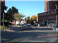
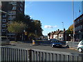
Photos of B79 7TE


Area Information
Living in B79 7TE offers a quiet, compact residential experience within a small cluster of homes in England. With a population of 1,333, the area is characterised by a low-key, community-oriented atmosphere. The median age of 47 suggests a mature demographic, with the majority of residents falling between 30 and 64 years old. This age range indicates a stable population, likely with established careers and families. The area is predominantly composed of houses, reflecting a traditional housing stock that contrasts with more urban or high-density environments. Despite its small size, B79 7TE benefits from excellent broadband connectivity, scoring 100 out of 100 for fixed broadband quality. However, residents should be aware of a medium crime risk, with a safety score of 61. This means standard security measures are advisable, though the area is not subject to environmental constraints like flood zones or protected landscapes. For those seeking a balance between seclusion and practicality, B79 7TE provides a straightforward, no-frills living experience.
- Area Type
- Postcode
- Area Size
- Not available
- Population
- 1333
- Population Density
- 2170 people/km²
The property market in B79 7TE is defined by its housing stock and ownership patterns. With 51% of homes owned by residents, the area is neither heavily rental-focused nor entirely owner-occupied. The prevalence of houses over flats or apartments suggests a traditional, low-density development, which may appeal to buyers seeking larger properties or gardens. As a small postcode area, the market is likely limited in scale, with limited scope for new developments. This could mean fewer choices for buyers, though the existing stock may offer good value. The lack of flats or high-rise buildings aligns with the area’s character as a quiet residential cluster. For those considering the area, the housing stock reflects a straightforward, practical approach to living, with no indication of high-end or luxury properties. Buyers should also consider the moderate crime risk, which may influence perceptions of safety and desirability.
House Prices in B79 7TE
No properties found in this postcode.
Energy Efficiency in B79 7TE
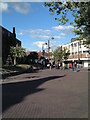
Residents of B79 7TE have access to a range of nearby amenities within practical reach. The area includes five retail outlets, such as Spar and Tamworth Co-operative Society, providing everyday shopping convenience. The Victoria Road Bus Interchange offers direct links to local and regional destinations, while five railway stations—including Tamworth High Level and Wilnecote—provide frequent services to nearby towns and cities. These transport options enhance the area’s accessibility, making it easier to commute or travel for leisure. The presence of multiple retail points and transport hubs suggests a functional lifestyle, where daily errands and travel are efficiently managed. While the area lacks large-scale leisure facilities, the proximity to rail and bus networks compensates by connecting residents to broader opportunities. The combination of local shops and transport links ensures a practical, low-stress lifestyle for those prioritising convenience over expansive amenities.
Amenities
Schools
| Rank | School | Type | Entry gender | Ages |
|---|
Explore more schools in this area
Go to Schools tabDemographics
The community in B79 7TE is predominantly composed of adults aged 30 to 64, with a median age of 47. This suggests a population that is largely in the prime working years, with fewer young families or retirees compared to other areas. Home ownership stands at 51%, meaning nearly half of residents rent their homes. The accommodation type is exclusively houses, indicating a lack of flats or apartments, which may appeal to those seeking more space or traditional housing. The predominant ethnic group is White, with no data provided on other ethnicities. The home ownership rate of 51% implies a mixed rental and owner-occupied market, though the smaller proportion of renters may suggest a stable, long-term resident base. The absence of specific data on deprivation levels means the area’s quality of life cannot be fully contextualised, but the demographic profile points to a mature, settled community.
Household Size
Accommodation Type
Tenure
Ethnic Group
Religion
Household Composition
Age
Household Deprivation
NS-SEC
Explore more demographic insights in this area
Go to Demographics tabPlanning
Planning Constraints
- Flood RiskPremium
- Ramsar Wetland SitesPremium
- Area of Outstanding Natural BeautyPremium
- Protected Nature ReservePremium
- Protected WoodlandPremium