Area Overview for B74 4BA
Photos of B74 4BA
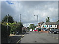
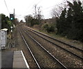


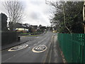
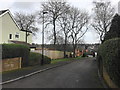
10 photos from this area
Area Information
Key information about the B74 4BA including its size, population, and administrative classification.
- Area Type
- Postcode
- Area Size
- 1.2 hectares
- Population
- 2001
- Population Density
- 2641 people/km²
House Prices in B74 4BA
21
Properties
£407,659
Average Sold Price
£209,200
Lowest Price
£675,000
Highest Price
Showing 21 properties
| Address | Type | Beds | Baths | Last Sale Price | Last Sale Date | |
|---|---|---|---|---|---|---|
| 20 Knighton Close, Sutton Coldfield, B74 4BA | house | 4 | 2 | £635,000 | Nov 2025 | |
| 4 Knighton Close, Sutton Coldfield, B74 4BA | Semi-detached | 4 | 2 | £592,500 | Feb 2024 | |
| 5 Knighton Close, Sutton Coldfield, B74 4BA | Semi-detached | 4 | 2 | £540,000 | Jul 2023 | |
| 14 Knighton Close, Sutton Coldfield, B74 4BA | Retail | 5 | 3 | £675,000 | Mar 2022 | |
| 7 Knighton Close, Sutton Coldfield, B74 4BA | house | - | - | £477,500 | Apr 2021 | |
| 3 Knighton Close, Sutton Coldfield, B74 4BA | house | - | - | £495,000 | Feb 2021 | |
| 6 Knighton Close, Sutton Coldfield, B74 4BA | house | - | - | £384,000 | Nov 2016 | |
| 22 Knighton Close, Sutton Coldfield, B74 4BA | Semi-detached | 4 | 2 | £400,000 | Sep 2016 | |
| 11 Knighton Close, Sutton Coldfield, B74 4BA | Semi-detached | 4 | - | £387,500 | Sep 2013 | |
| 16 Knighton Close, Sutton Coldfield, B74 4BA | Semi-detached | 3 | 1 | £270,000 | Feb 2013 |
Page 1 of 3
Energy Efficiency in B74 4BA
Amenities
Schools
| Rank | School | Type | Entry gender | Ages |
|---|
Explore more schools in this area
Go to Schools tabDemographics
Household Size
Two person
most common
Accommodation Type
Houses
most common
Tenure
80
majority
Ethnic Group
White
most common
Religion
N/A
most common
Household Composition
N/A
most common
Age
47
median
Adults (30-64 years)
most common
Household Deprivation
N/A
with no deprivation
NS-SEC
45
in Lower managerial occupations
Explore more demographic insights in this area
Go to Demographics tabPlanning
Planning Constraints
- Flood RiskPremium
- Ramsar Wetland SitesPremium
- Area of Outstanding Natural BeautyPremium
- Protected Nature ReservePremium
- Protected WoodlandPremium