Area Overview for B74 4AS
Photos of B74 4AS
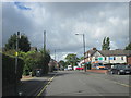
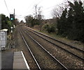


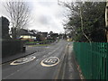
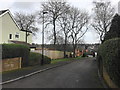
10 photos from this area
Area Information
Key information about the B74 4AS including its size, population, and administrative classification.
- Area Type
- Postcode
- Area Size
- 6718 m²
- Population
- 2001
- Population Density
- 2641 people/km²
House Prices in B74 4AS
12
Properties
£376,056
Average Sold Price
£260,000
Lowest Price
£650,000
Highest Price
Showing 12 properties
| Address | Type | Beds | Baths | Last Sale Price | Last Sale Date | |
|---|---|---|---|---|---|---|
| 90 Clarence Road, Sutton Four Oaks, Sutton Coldfield, B74 4AS | Detached | 4 | 1 | £650,000 | Oct 2023 | |
| 104 Clarence Road, Sutton Four Oaks, Sutton Coldfield, B74 4AS | house | - | - | £495,000 | Jun 2021 | |
| 88 Clarence Road, Sutton Four Oaks, Sutton Coldfield, B74 4AS | Detached | 3 | 1 | £336,500 | Mar 2016 | |
| 100 Clarence Road, Sutton Four Oaks, Sutton Coldfield, B74 4AS | Bungalow | - | - | £382,500 | May 2015 | |
| 75 Clarence Road, Sutton Four Oaks, Sutton Coldfield, B74 4AS | Semi-detached | 3 | 1 | £309,500 | Oct 2013 | |
| 77 Clarence Road, Sutton Four Oaks, Sutton Coldfield, B74 4AS | Semi-detached | 4 | 3 | £309,950 | May 2010 | |
| 94 Clarence Road, Sutton Four Oaks, Sutton Coldfield, B74 4AS | Detached | - | - | £265,000 | Sep 2006 | |
| 102 Clarence Road, Sutton Four Oaks, Sutton Coldfield, B74 4AS | Detached | - | - | £260,000 | May 2002 | |
| Annexe At Rear, 100 Clarence Road, Sutton Four Oaks, Sutton Coldfield, B74 4AS | Detached | - | - | - | - | |
| 79 Clarence Road, Sutton Four Oaks, Sutton Coldfield, B74 4AS | Semi-detached | - | - | - | - |
Page 1 of 2
Energy Efficiency in B74 4AS
Amenities
Schools
| Rank | School | Type | Entry gender | Ages |
|---|
Explore more schools in this area
Go to Schools tabDemographics
Household Size
Two person
most common
Accommodation Type
Houses
most common
Tenure
80
majority
Ethnic Group
White
most common
Religion
N/A
most common
Household Composition
N/A
most common
Age
47
median
Adults (30-64 years)
most common
Household Deprivation
N/A
with no deprivation
NS-SEC
45
in Lower managerial occupations
Explore more demographic insights in this area
Go to Demographics tabPlanning
Planning Constraints
- Flood RiskPremium
- Ramsar Wetland SitesPremium
- Area of Outstanding Natural BeautyPremium
- Protected Nature ReservePremium
- Protected WoodlandPremium