Area Overview for B74 3JZ
Photos of B74 3JZ
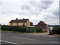
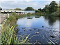
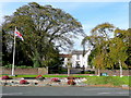

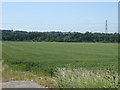

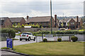
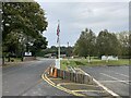
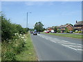
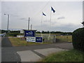
11 photos from this area
Area Information
Key information about the B74 3JZ including its size, population, and administrative classification.
- Area Type
- Postcode
- Area Size
- 1.2 hectares
- Population
- 1524
- Population Density
- 1828 people/km²
House Prices in B74 3JZ
13
Properties
£358,110
Average Sold Price
£44,500
Lowest Price
£625,000
Highest Price
Showing 13 properties
| Address | Type | Beds | Baths | Last Sale Price | Last Sale Date | |
|---|---|---|---|---|---|---|
| 20 Lindrosa Road, Streetly, B74 3JZ | Detached | 5 | 1 | £625,000 | Dec 2024 | |
| 24 Lindrosa Road, Streetly, B74 3JZ | Detached | 4 | 2 | £600,000 | Jun 2024 | |
| 29 Lindrosa Road, Streetly, B74 3JZ | Flat | 2 | 1 | £205,000 | Jan 2024 | |
| 32 Lindrosa Road, Streetly, B74 3JZ | Detached | 3 | 2 | £500,000 | Sep 2023 | |
| 38 Lindrosa Road, Streetly, B74 3JZ | Bungalow | - | - | £477,500 | Nov 2018 | |
| 34 Lindrosa Road, Streetly, B74 3JZ | Detached | 3 | 1 | £399,995 | Jul 2018 | |
| 28 Lindrosa Road, Streetly, B74 3JZ | house | 3 | - | £342,000 | Jul 2015 | |
| 30 Lindrosa Road, Streetly, B74 3JZ | Detached | - | - | £265,100 | Oct 2004 | |
| 31 Lindrosa Road, Streetly, B74 3JZ | Flat | - | - | £44,500 | Feb 1996 | |
| 22 Lindrosa Road, Streetly, B74 3JZ | Detached | - | - | £122,000 | Jun 1995 |
Page 1 of 2
Energy Efficiency in B74 3JZ
Amenities
Schools
| Rank | School | Type | Entry gender | Ages |
|---|
Explore more schools in this area
Go to Schools tabDemographics
Household Size
Two person
most common
Accommodation Type
Houses
most common
Tenure
88
majority
Ethnic Group
White
most common
Religion
N/A
most common
Household Composition
N/A
most common
Age
47
median
Adults (30-64 years)
most common
Household Deprivation
N/A
with no deprivation
NS-SEC
45
in Lower managerial occupations
Explore more demographic insights in this area
Go to Demographics tabPlanning
Planning Constraints
- Flood RiskPremium
- Ramsar Wetland SitesPremium
- Area of Outstanding Natural BeautyPremium
- Protected Nature ReservePremium
- Protected WoodlandPremium