Area Overview for B74 3LF
Photos of B74 3LF
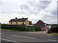
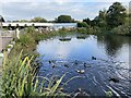
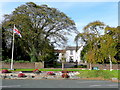
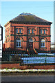

11 photos from this area
Area Information
Key information about the B74 3LF including its size, population, and administrative classification.
- Area Type
- Postcode
- Area Size
- 1.5 hectares
- Population
- 1524
- Population Density
- 1828 people/km²
House Prices in B74 3LF
34
Properties
£230,261
Average Sold Price
£70,000
Lowest Price
£375,000
Highest Price
Showing 34 properties
| Address | Type | Beds | Baths | Last Sale Price | Last Sale Date | |
|---|---|---|---|---|---|---|
| 56 Coniston Road, Streetly, B74 3LF | house | - | - | £360,000 | Nov 2024 | |
| 49 Coniston Road, Streetly, B74 3LF | Semi-detached | 3 | 1 | £275,000 | Feb 2024 | |
| 44 Coniston Road, Streetly, B74 3LF | house | - | - | £320,000 | May 2023 | |
| 57 Coniston Road, Streetly, B74 3LF | Semi-detached | 3 | 1 | £322,000 | Sep 2021 | |
| 63 Coniston Road, Streetly, B74 3LF | house | - | - | £298,000 | Apr 2021 | |
| 35 Coniston Road, Streetly, B74 3LF | house | - | - | £375,000 | Mar 2021 | |
| 42 Coniston Road, Streetly, B74 3LF | Semi-detached | 3 | 1 | £317,000 | Mar 2020 | |
| 58 Coniston Road, Streetly, B74 3LF | Semi-detached | 3 | 1 | £272,500 | Jun 2018 | |
| 33 Coniston Road, Streetly, B74 3LF | Semi-detached | 3 | - | £275,000 | May 2018 | |
| 68 Coniston Road, Streetly, B74 3LF | Semi-detached | 3 | 1 | £305,000 | Jul 2017 |
Page 1 of 4
Energy Efficiency in B74 3LF
Amenities
Schools
| Rank | School | Type | Entry gender | Ages |
|---|
Explore more schools in this area
Go to Schools tabDemographics
Household Size
Two person
most common
Accommodation Type
Houses
most common
Tenure
88
majority
Ethnic Group
White
most common
Religion
N/A
most common
Household Composition
N/A
most common
Age
47
median
Adults (30-64 years)
most common
Household Deprivation
N/A
with no deprivation
NS-SEC
45
in Lower managerial occupations
Explore more demographic insights in this area
Go to Demographics tabPlanning
Planning Constraints
- Flood RiskPremium
- Ramsar Wetland SitesPremium
- Area of Outstanding Natural BeautyPremium
- Protected Nature ReservePremium
- Protected WoodlandPremium