Area Overview for B74 3JY
Photos of B74 3JY
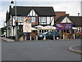
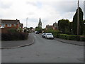
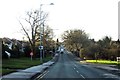
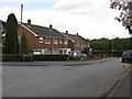
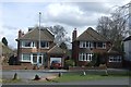
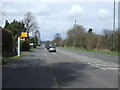
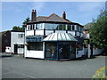
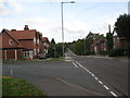
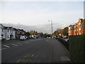
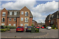
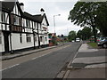
13 photos from this area
Area Information
Key information about the B74 3JY including its size, population, and administrative classification.
- Area Type
- Postcode
- Area Size
- 1.2 hectares
- Population
- 1524
- Population Density
- 1828 people/km²
House Prices in B74 3JY
18
Properties
£325,000
Average Sold Price
£189,999
Lowest Price
£456,000
Highest Price
Showing 18 properties
| Address | Type | Beds | Baths | Last Sale Price | Last Sale Date | |
|---|---|---|---|---|---|---|
| 25 Lindrosa Road, Streetly, B74 3JY | Detached | 3 | 1 | £425,000 | Jul 2023 | |
| 23 Lindrosa Road, Streetly, B74 3JY | Semi-detached | 3 | - | £435,000 | Aug 2022 | |
| 16 Lindrosa Road, Streetly, B74 3JY | house | - | - | £418,000 | Mar 2018 | |
| 4 Lindrosa Road, Streetly, B74 3JY | Detached | 4 | - | £352,500 | Jan 2014 | |
| 11 Lindrosa Road, Streetly, B74 3JY | Semi-detached | 3 | 1 | £189,999 | May 2009 | |
| 2 Lindrosa Road, Streetly, B74 3JY | Retail | 3 | 1 | £456,000 | Aug 2007 | |
| 17 Lindrosa Road, Streetly, B74 3JY | Semi-detached | - | - | £210,000 | Jun 2006 | |
| 21 Lindrosa Road, Streetly, B74 3JY | Semi-detached | - | - | £237,500 | Aug 2005 | |
| 9 Lindrosa Road, Streetly, B74 3JY | house | 3 | - | £247,000 | Nov 2004 | |
| 18 Lindrosa Road, Streetly, B74 3JY | Detached | - | - | £326,000 | Nov 2004 |
Page 1 of 2
Energy Efficiency in B74 3JY
Amenities
Schools
| Rank | School | Type | Entry gender | Ages |
|---|
Explore more schools in this area
Go to Schools tabDemographics
Household Size
Two person
most common
Accommodation Type
Houses
most common
Tenure
88
majority
Ethnic Group
White
most common
Religion
N/A
most common
Household Composition
N/A
most common
Age
47
median
Adults (30-64 years)
most common
Household Deprivation
N/A
with no deprivation
NS-SEC
45
in Lower managerial occupations
Explore more demographic insights in this area
Go to Demographics tabPlanning
Planning Constraints
- Flood RiskPremium
- Ramsar Wetland SitesPremium
- Area of Outstanding Natural BeautyPremium
- Protected Nature ReservePremium
- Protected WoodlandPremium