Area Overview for B71 2AY
Photos of B71 2AY
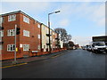
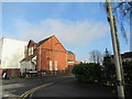

27 photos from this area
Area Information
Key information about the B71 2AY including its size, population, and administrative classification.
- Area Type
- Postcode
- Area Size
- 1.2 hectares
- Population
- 1821
- Population Density
- 7319 people/km²
House Prices in B71 2AY
21
Properties
£114,259
Average Sold Price
£45,500
Lowest Price
£245,000
Highest Price
Showing 21 properties
| Address | Type | Beds | Baths | Last Sale Price | Last Sale Date | |
|---|---|---|---|---|---|---|
| 18 Wyld Close, West Bromwich, B71 2AY | Terraced | 3 | 1 | £220,000 | Oct 2025 | |
| 15 Wyld Close, West Bromwich, B71 2AY | Terraced | 3 | 1 | £200,000 | Feb 2024 | |
| 14 Wyld Close, West Bromwich, B71 2AY | Retail | 3 | 1 | £215,000 | Oct 2022 | |
| 12 Wyld Close, West Bromwich, B71 2AY | house | - | - | £245,000 | Oct 2021 | |
| 22 Wyld Close, West Bromwich, B71 2AY | Terraced | 2 | 1 | £135,000 | Nov 2017 | |
| 11 Wyld Close, West Bromwich, B71 2AY | house | - | - | £157,000 | Jun 2016 | |
| 6 Wyld Close, West Bromwich, B71 2AY | Semi-detached | 3 | - | £129,000 | Nov 2015 | |
| 10 Wyld Close, West Bromwich, B71 2AY | Terraced | 2 | 1 | £116,000 | Aug 2015 | |
| 5 Wyld Close, West Bromwich, B71 2AY | house | - | - | £123,500 | Mar 2012 | |
| 17 Wyld Close, West Bromwich, B71 2AY | house | - | - | £120,000 | May 2011 |
Page 1 of 3
Energy Efficiency in B71 2AY
Amenities
Schools
| Rank | School | Type | Entry gender | Ages |
|---|
Explore more schools in this area
Go to Schools tabDemographics
Household Size
Family (3-5 people)
most common
Accommodation Type
Houses
most common
Tenure
65
majority
Ethnic Group
White
most common
Religion
N/A
most common
Household Composition
N/A
most common
Age
47
median
Adults (30-64 years)
most common
Household Deprivation
N/A
with no deprivation
NS-SEC
16
in Lower managerial occupations
Explore more demographic insights in this area
Go to Demographics tabPlanning
Planning Constraints
- Flood RiskPremium
- Ramsar Wetland SitesPremium
- Area of Outstanding Natural BeautyPremium
- Protected Nature ReservePremium
- Protected WoodlandPremium