Area Overview for B71 2AB
Photos of B71 2AB
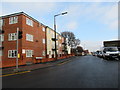
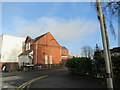
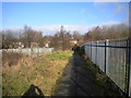
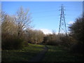
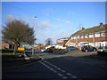
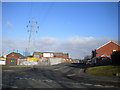
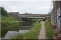
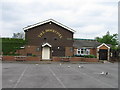
27 photos from this area
Area Information
Key information about the B71 2AB including its size, population, and administrative classification.
- Area Type
- Postcode
- Area Size
- 2.8 hectares
- Population
- 1821
- Population Density
- 7319 people/km²
House Prices in B71 2AB
55
Properties
£133,156
Average Sold Price
£39,500
Lowest Price
£375,000
Highest Price
Showing 55 properties
| Address | Type | Beds | Baths | Last Sale Price | Last Sale Date | |
|---|---|---|---|---|---|---|
| 44 Rydding Square, West Bromwich, B71 2AB | Detached | 3 | 1 | £375,000 | Sep 2025 | |
| 50 Rydding Square, West Bromwich, B71 2AB | Detached | 3 | - | £255,000 | Aug 2025 | |
| 66 Rydding Square, West Bromwich, B71 2AB | Terraced | 3 | 1 | £187,000 | Feb 2025 | |
| 63 Rydding Square, West Bromwich, B71 2AB | Semi-detached | 4 | 2 | £277,000 | Dec 2023 | |
| 25 Rydding Square, West Bromwich, B71 2AB | Semi-detached | 3 | 1 | £228,000 | Jul 2023 | |
| 19 Rydding Square, West Bromwich, B71 2AB | Retail | 3 | 2 | £230,000 | Jul 2022 | |
| 24 Rydding Square, West Bromwich, B71 2AB | house | - | - | £222,000 | Jan 2022 | |
| 73 Rydding Square, West Bromwich, B71 2AB | Detached | 3 | 2 | £135,000 | Nov 2021 | |
| 52 Rydding Square, West Bromwich, B71 2AB | house | - | - | £110,000 | May 2021 | |
| 69 Rydding Square, West Bromwich, B71 2AB | Semi-detached | - | - | £70,000 | Jun 2019 |
Page 1 of 6
Energy Efficiency in B71 2AB
Amenities
Schools
| Rank | School | Type | Entry gender | Ages |
|---|
Explore more schools in this area
Go to Schools tabDemographics
Household Size
Family (3-5 people)
most common
Accommodation Type
Houses
most common
Tenure
65
majority
Ethnic Group
White
most common
Religion
N/A
most common
Household Composition
N/A
most common
Age
47
median
Adults (30-64 years)
most common
Household Deprivation
N/A
with no deprivation
NS-SEC
16
in Lower managerial occupations
Explore more demographic insights in this area
Go to Demographics tabPlanning
Planning Constraints
- Flood RiskPremium
- Ramsar Wetland SitesPremium
- Area of Outstanding Natural BeautyPremium
- Protected Nature ReservePremium
- Protected WoodlandPremium