Area Overview for B71 2AA
Photos of B71 2AA
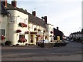
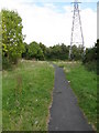
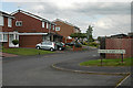
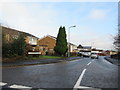
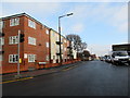
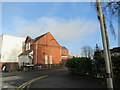
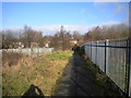
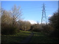
27 photos from this area
Area Information
Key information about the B71 2AA including its size, population, and administrative classification.
- Area Type
- Postcode
- Area Size
- 9546 m²
- Population
- 1821
- Population Density
- 7319 people/km²
House Prices in B71 2AA
17
Properties
£110,700
Average Sold Price
£59,000
Lowest Price
£199,300
Highest Price
Showing 17 properties
| Address | Type | Beds | Baths | Last Sale Price | Last Sale Date | |
|---|---|---|---|---|---|---|
| 69 Witton Lane, West Bromwich, B71 2AA | Terraced | 3 | 1 | £199,300 | Mar 2023 | |
| 57 Witton Lane, West Bromwich, B71 2AA | Terraced | 3 | 1 | £140,000 | Dec 2020 | |
| 67 Witton Lane, West Bromwich, B71 2AA | Terraced | 2 | - | £77,000 | May 2017 | |
| 61 Witton Lane, West Bromwich, B71 2AA | Terraced | 3 | - | £96,000 | Mar 2016 | |
| 63 Witton Lane, West Bromwich, B71 2AA | Terraced | 3 | - | £96,000 | Oct 2015 | |
| 25 Witton Lane, West Bromwich, B71 2AA | Semi-detached | 3 | 1 | £111,000 | Jul 2006 | |
| 81 Witton Lane, West Bromwich, B71 2AA | house | - | - | £127,000 | Jun 2005 | |
| 59 Witton Lane, West Bromwich, B71 2AA | Terraced | - | - | £91,000 | Nov 2004 | |
| 83 Witton Lane, West Bromwich, B71 2AA | house | - | - | £59,000 | Apr 1996 | |
| 55 Witton Lane, West Bromwich, B71 2AA | Terraced | - | - | - | - |
Page 1 of 2
Energy Efficiency in B71 2AA
Amenities
Schools
| Rank | School | Type | Entry gender | Ages |
|---|
Explore more schools in this area
Go to Schools tabDemographics
Household Size
Family (3-5 people)
most common
Accommodation Type
Houses
most common
Tenure
65
majority
Ethnic Group
White
most common
Religion
N/A
most common
Household Composition
N/A
most common
Age
47
median
Adults (30-64 years)
most common
Household Deprivation
N/A
with no deprivation
NS-SEC
16
in Lower managerial occupations
Explore more demographic insights in this area
Go to Demographics tabPlanning
Planning Constraints
- Flood RiskPremium
- Ramsar Wetland SitesPremium
- Area of Outstanding Natural BeautyPremium
- Protected Nature ReservePremium
- Protected WoodlandPremium