Area Overview for B69 1EP
Photos of B69 1EP
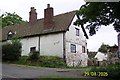
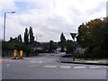
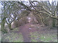
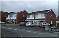
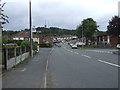
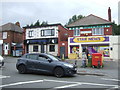
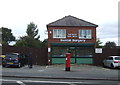
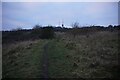
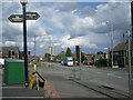
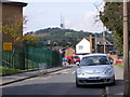

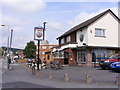
13 photos from this area
Area Information
Key information about the B69 1EP including its size, population, and administrative classification.
- Area Type
- Postcode
- Area Size
- 1.3 hectares
- Population
- 1448
- Population Density
- 2850 people/km²
House Prices in B69 1EP
30
Properties
£123,279
Average Sold Price
£39,000
Lowest Price
£200,000
Highest Price
Showing 30 properties
| Address | Type | Beds | Baths | Last Sale Price | Last Sale Date | |
|---|---|---|---|---|---|---|
| 24 Bredon Road, Oldbury, B69 1EP | Semi-detached | 3 | 1 | £200,000 | Mar 2025 | |
| 26 Bredon Road, Oldbury, B69 1EP | Semi-detached | 3 | 1 | £195,000 | Dec 2022 | |
| 28 Bredon Road, Oldbury, B69 1EP | house | - | - | £185,000 | Jan 2022 | |
| 16 Bredon Road, Oldbury, B69 1EP | house | - | - | £139,000 | Oct 2020 | |
| 1 Bredon Road, Oldbury, B69 1EP | house | - | - | £159,950 | Aug 2020 | |
| 6 Bredon Road, Oldbury, B69 1EP | Semi-detached | 3 | 1 | £122,000 | Feb 2019 | |
| 17 Bredon Road, Oldbury, B69 1EP | Semi-detached | 3 | 1 | £138,000 | Sep 2018 | |
| 38 Bredon Road, Oldbury, B69 1EP | house | - | - | £94,000 | Jun 2014 | |
| 8 Bredon Road, Oldbury, B69 1EP | Semi-detached | 3 | 1 | £110,000 | Jan 2014 | |
| 11 Bredon Road, Oldbury, B69 1EP | Semi-detached | - | - | £105,000 | Apr 2009 |
Page 1 of 3
Energy Efficiency in B69 1EP
Amenities
Schools
| Rank | School | Type | Entry gender | Ages |
|---|
Explore more schools in this area
Go to Schools tabDemographics
Household Size
Family (3-5 people)
most common
Accommodation Type
Houses
most common
Tenure
48
majority
Ethnic Group
White
most common
Religion
N/A
most common
Household Composition
N/A
most common
Age
47
median
Adults (30-64 years)
most common
Household Deprivation
N/A
with no deprivation
NS-SEC
18
in Lower managerial occupations
Explore more demographic insights in this area
Go to Demographics tabPlanning
Planning Constraints
- Flood RiskPremium
- Ramsar Wetland SitesPremium
- Area of Outstanding Natural BeautyPremium
- Protected Nature ReservePremium
- Protected WoodlandPremium