Area Overview for B69 1DZ
Photos of B69 1DZ
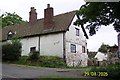
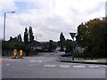
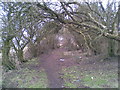
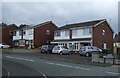
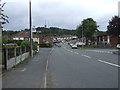
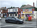
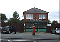
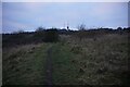

13 photos from this area
Area Information
Key information about the B69 1DZ including its size, population, and administrative classification.
- Area Type
- Postcode
- Area Size
- 9795 m²
- Population
- 1448
- Population Density
- 2850 people/km²
House Prices in B69 1DZ
33
Properties
£98,939
Average Sold Price
£52,500
Lowest Price
£142,500
Highest Price
Showing 33 properties
| Address | Type | Beds | Baths | Last Sale Price | Last Sale Date | |
|---|---|---|---|---|---|---|
| 20 Martley Road, Oldbury, B69 1DZ | Flat | 2 | 1 | £85,000 | Nov 2022 | |
| 4 Martley Road, Oldbury, B69 1DZ | Semi-detached | 3 | 1 | £142,500 | Jun 2019 | |
| 28 Martley Road, Oldbury, B69 1DZ | Terraced | 3 | 1 | £138,000 | Oct 2017 | |
| 18 Martley Road, Oldbury, B69 1DZ | Flat | - | - | £55,000 | Nov 2015 | |
| 24 Martley Road, Oldbury, B69 1DZ | Semi-detached | 3 | 1 | £96,000 | Jul 2015 | |
| 6 Martley Road, Oldbury, B69 1DZ | Semi-detached | - | - | £112,500 | Jan 2007 | |
| 32 Martley Road, Oldbury, B69 1DZ | Terraced | - | - | £124,000 | Jan 2007 | |
| 2 Martley Road, Oldbury, B69 1DZ | Semi-detached | - | - | £84,950 | Oct 2002 | |
| 34 Martley Road, Oldbury, B69 1DZ | Terraced | - | - | £52,500 | Jul 2000 | |
| 54 Martley Road, Oldbury, B69 1DZ | Flat | - | - | - | - |
Page 1 of 4
Energy Efficiency in B69 1DZ
Amenities
Schools
| Rank | School | Type | Entry gender | Ages |
|---|
Explore more schools in this area
Go to Schools tabDemographics
Household Size
Family (3-5 people)
most common
Accommodation Type
Houses
most common
Tenure
48
majority
Ethnic Group
White
most common
Religion
N/A
most common
Household Composition
N/A
most common
Age
47
median
Adults (30-64 years)
most common
Household Deprivation
N/A
with no deprivation
NS-SEC
18
in Lower managerial occupations
Explore more demographic insights in this area
Go to Demographics tabPlanning
Planning Constraints
- Flood RiskPremium
- Ramsar Wetland SitesPremium
- Area of Outstanding Natural BeautyPremium
- Protected Nature ReservePremium
- Protected WoodlandPremium