Area Overview for B68 0SS
Photos of B68 0SS
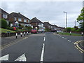

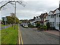
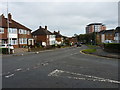
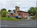

19 photos from this area
Area Information
Key information about the B68 0SS including its size, population, and administrative classification.
- Area Type
- Postcode
- Area Size
- 1.3 hectares
- Population
- 1736
- Population Density
- 2513 people/km²
House Prices in B68 0SS
38
Properties
£120,984
Average Sold Price
£38,000
Lowest Price
£218,000
Highest Price
Showing 38 properties
| Address | Type | Beds | Baths | Last Sale Price | Last Sale Date | |
|---|---|---|---|---|---|---|
| 34 Chester Rise, Oldbury, B68 0SS | Terraced | 2 | 1 | £164,000 | May 2025 | |
| 37 Chester Rise, Oldbury, B68 0SS | Terraced | 2 | 1 | £185,000 | Oct 2024 | |
| 14 Chester Rise, Oldbury, B68 0SS | Semi-detached | 3 | 2 | £218,000 | Jan 2022 | |
| 27 Chester Rise, Oldbury, B68 0SS | house | - | - | £202,000 | Jul 2021 | |
| 16 Chester Rise, Oldbury, B68 0SS | Terraced | 2 | 1 | £98,500 | Jun 2019 | |
| 3 Chester Rise, Oldbury, B68 0SS | house | - | - | £153,000 | Nov 2018 | |
| 13 Chester Rise, Oldbury, B68 0SS | Semi-detached | 3 | 1 | £147,000 | Sep 2018 | |
| 8 Chester Rise, Oldbury, B68 0SS | Terraced | 3 | - | £117,000 | Oct 2015 | |
| 19 Chester Rise, Oldbury, B68 0SS | Terraced | 3 | - | £97,000 | Feb 2013 | |
| 20 Chester Rise, Oldbury, B68 0SS | house | - | - | £121,000 | Nov 2012 |
Page 1 of 4
Energy Efficiency in B68 0SS
Amenities
Schools
| Rank | School | Type | Entry gender | Ages |
|---|
Explore more schools in this area
Go to Schools tabDemographics
Household Size
One person
most common
Accommodation Type
Houses
most common
Tenure
51
majority
Ethnic Group
White
most common
Religion
N/A
most common
Household Composition
N/A
most common
Age
47
median
Adults (30-64 years)
most common
Household Deprivation
N/A
with no deprivation
NS-SEC
20
in Lower managerial occupations
Explore more demographic insights in this area
Go to Demographics tabPlanning
Planning Constraints
- Flood RiskPremium
- Ramsar Wetland SitesPremium
- Area of Outstanding Natural BeautyPremium
- Protected Nature ReservePremium
- Protected WoodlandPremium