Area Overview for B68 0EJ
Photos of B68 0EJ
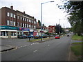
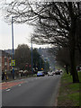
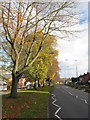
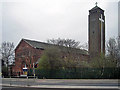
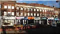
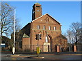
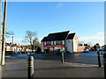
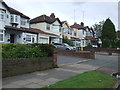
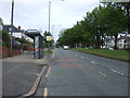
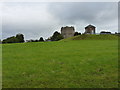
25 photos from this area
Area Information
Key information about the B68 0EJ including its size, population, and administrative classification.
- Area Type
- Postcode
- Area Size
- 1.4 hectares
- Population
- 1585
- Population Density
- 6477 people/km²
House Prices in B68 0EJ
39
Properties
£182,164
Average Sold Price
£45,000
Lowest Price
£350,000
Highest Price
Showing 39 properties
| Address | Type | Beds | Baths | Last Sale Price | Last Sale Date | |
|---|---|---|---|---|---|---|
| 176 Castle Road West, Oldbury, B68 0EJ | Semi-detached | 3 | 1 | £235,000 | Jul 2025 | |
| 196 Castle Road West, Oldbury, B68 0EJ | house | - | - | £218,000 | Mar 2025 | |
| 148 Castle Road West, Oldbury, B68 0EJ | Semi-detached | 3 | 2 | £350,000 | Mar 2024 | |
| 156 Castle Road West, Oldbury, B68 0EJ | Semi-detached | 3 | 1 | £280,000 | Jul 2023 | |
| 152 Castle Road West, Oldbury, B68 0EJ | house | 3 | - | £240,000 | Feb 2022 | |
| 200 Castle Road West, Oldbury, B68 0EJ | Semi-detached | 3 | 2 | £217,500 | Aug 2021 | |
| 180 Castle Road West, Oldbury, B68 0EJ | house | - | - | £234,000 | Mar 2021 | |
| 166 Castle Road West, Oldbury, B68 0EJ | house | - | - | £233,950 | Feb 2021 | |
| 188 Castle Road West, Oldbury, B68 0EJ | Bungalow | 3 | 1 | £220,000 | Nov 2019 | |
| 210 Castle Road West, Oldbury, B68 0EJ | house | - | - | £210,000 | May 2019 |
Page 1 of 4
Energy Efficiency in B68 0EJ
Amenities
Schools
| Rank | School | Type | Entry gender | Ages |
|---|
Explore more schools in this area
Go to Schools tabDemographics
Household Size
Family (3-5 people)
most common
Accommodation Type
Houses
most common
Tenure
82
majority
Ethnic Group
White
most common
Religion
N/A
most common
Household Composition
N/A
most common
Age
47
median
Adults (30-64 years)
most common
Household Deprivation
N/A
with no deprivation
NS-SEC
37
in Lower managerial occupations
Explore more demographic insights in this area
Go to Demographics tabPlanning
Planning Constraints
- Flood RiskPremium
- Ramsar Wetland SitesPremium
- Area of Outstanding Natural BeautyPremium
- Protected Nature ReservePremium
- Protected WoodlandPremium