Area Overview for B68 0AT
Photos of B68 0AT
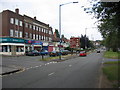
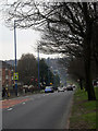
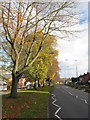
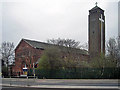
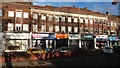

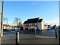
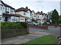
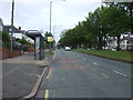
25 photos from this area
Area Information
Key information about the B68 0AT including its size, population, and administrative classification.
- Area Type
- Postcode
- Area Size
- 4969 m²
- Population
- 1829
- Population Density
- 5910 people/km²
House Prices in B68 0AT
13
Properties
£129,745
Average Sold Price
£54,000
Lowest Price
£229,950
Highest Price
Showing 13 properties
| Address | Type | Beds | Baths | Last Sale Price | Last Sale Date | |
|---|---|---|---|---|---|---|
| 69 Holly Road, Oldbury, B68 0AT | house | - | - | £152,000 | Feb 2017 | |
| 67 Holly Road, Oldbury, B68 0AT | Semi-detached | 4 | 1 | £229,950 | Jan 2017 | |
| 66 Holly Road, Oldbury, B68 0AT | Semi-detached | 3 | 1 | £150,000 | Sep 2015 | |
| 61 Holly Road, Oldbury, B68 0AT | house | 3 | 1 | £125,000 | Mar 2012 | |
| 58 Holly Road, Oldbury, B68 0AT | house | - | - | £156,000 | Feb 2010 | |
| 64 Holly Road, Oldbury, B68 0AT | Semi-detached | - | - | £140,000 | Sep 2007 | |
| 63 Holly Road, Oldbury, B68 0AT | Semi-detached | - | - | £130,000 | Aug 2003 | |
| 73 Holly Road, Oldbury, B68 0AT | Semi-detached | - | - | £93,000 | Apr 2002 | |
| 60 Holly Road, Oldbury, B68 0AT | Semi-detached | - | - | £54,000 | Jun 1998 | |
| 65 Holly Road, Oldbury, B68 0AT | Semi-detached | - | - | £67,500 | Aug 1996 |
Page 1 of 2
Energy Efficiency in B68 0AT
Amenities
Schools
| Rank | School | Type | Entry gender | Ages |
|---|
Explore more schools in this area
Go to Schools tabDemographics
Household Size
Family (3-5 people)
most common
Accommodation Type
Houses
most common
Tenure
71
majority
Ethnic Group
White
most common
Religion
N/A
most common
Household Composition
N/A
most common
Age
47
median
Adults (30-64 years)
most common
Household Deprivation
N/A
with no deprivation
NS-SEC
31
in Lower managerial occupations
Explore more demographic insights in this area
Go to Demographics tabPlanning
Planning Constraints
- Flood RiskPremium
- Ramsar Wetland SitesPremium
- Area of Outstanding Natural BeautyPremium
- Protected Nature ReservePremium
- Protected WoodlandPremium