Area Overview for B68 0AL
Photos of B68 0AL
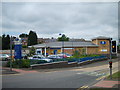
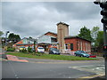
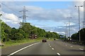
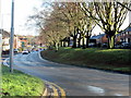

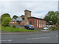

19 photos from this area
Area Information
Key information about the B68 0AL including its size, population, and administrative classification.
- Area Type
- Postcode
- Area Size
- 1.7 hectares
- Population
- 1829
- Population Density
- 5910 people/km²
House Prices in B68 0AL
34
Properties
£123,182
Average Sold Price
£40,000
Lowest Price
£223,000
Highest Price
Showing 34 properties
| Address | Type | Beds | Baths | Last Sale Price | Last Sale Date | |
|---|---|---|---|---|---|---|
| 33 Cumberland Road, Oldbury, B68 0AL | Terraced | 3 | 1 | £190,000 | Aug 2025 | |
| 9 Cumberland Road, Oldbury, B68 0AL | house | - | - | £223,000 | Feb 2025 | |
| 10 Cumberland Road, Oldbury, B68 0AL | Terraced | 2 | 1 | £190,000 | Dec 2024 | |
| 25 Cumberland Road, Oldbury, B68 0AL | Terraced | 3 | 1 | £188,000 | Aug 2024 | |
| 34 Cumberland Road, Oldbury, B68 0AL | Terraced | 3 | 1 | £125,000 | Dec 2019 | |
| 20 Cumberland Road, Oldbury, B68 0AL | Terraced | 3 | 2 | £146,000 | Oct 2019 | |
| 14 Cumberland Road, Oldbury, B68 0AL | Semi-detached | 3 | 1 | £122,000 | Jan 2018 | |
| 36 Cumberland Road, Oldbury, B68 0AL | house | 2 | 1 | £140,000 | Nov 2017 | |
| 29 Cumberland Road, Oldbury, B68 0AL | Terraced | 2 | 1 | £116,000 | Sep 2017 | |
| 6 Cumberland Road, Oldbury, B68 0AL | Terraced | 3 | - | £141,750 | Feb 2017 |
Page 1 of 4
Energy Efficiency in B68 0AL
Amenities
Schools
| Rank | School | Type | Entry gender | Ages |
|---|
Explore more schools in this area
Go to Schools tabDemographics
Household Size
Family (3-5 people)
most common
Accommodation Type
Houses
most common
Tenure
71
majority
Ethnic Group
White
most common
Religion
N/A
most common
Household Composition
N/A
most common
Age
47
median
Adults (30-64 years)
most common
Household Deprivation
N/A
with no deprivation
NS-SEC
31
in Lower managerial occupations
Explore more demographic insights in this area
Go to Demographics tabPlanning
Planning Constraints
- Flood RiskPremium
- Ramsar Wetland SitesPremium
- Area of Outstanding Natural BeautyPremium
- Protected Nature ReservePremium
- Protected WoodlandPremium