Area Overview for B68 0LA
Photos of B68 0LA


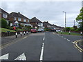

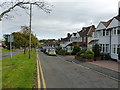
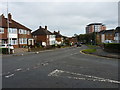


19 photos from this area
Area Information
Key information about the B68 0LA including its size, population, and administrative classification.
- Area Type
- Postcode
- Area Size
- 6117 m²
- Population
- 1829
- Population Density
- 5910 people/km²
House Prices in B68 0LA
16
Properties
£114,811
Average Sold Price
£42,000
Lowest Price
£223,700
Highest Price
Showing 16 properties
| Address | Type | Beds | Baths | Last Sale Price | Last Sale Date | |
|---|---|---|---|---|---|---|
| 52 Tame Road, Oldbury, B68 0LA | Flat | 1 | 1 | £102,000 | Feb 2024 | |
| 58 Tame Road, Oldbury, B68 0LA | Flat | - | - | £105,137 | Nov 2022 | |
| 50 Tame Road, Oldbury, B68 0LA | Flat | - | - | £100,000 | Nov 2021 | |
| 194 Tame Road, Oldbury, B68 0LA | Terraced | 3 | 1 | £136,000 | Dec 2020 | |
| 202 Tame Road, Oldbury, B68 0LA | Bungalow | 2 | 1 | £223,700 | Jun 2019 | |
| 190 Tame Road, Oldbury, B68 0LA | Terraced | 3 | 1 | £132,500 | Jul 2018 | |
| 60 Tame Road, Oldbury, B68 0LA | Flat | - | - | £76,000 | May 2015 | |
| 200 Tame Road, Oldbury, B68 0LA | Bungalow | 2 | 1 | £159,000 | Sep 2014 | |
| 198 Tame Road, Oldbury, B68 0LA | Semi-detached | 3 | 1 | £109,500 | Aug 2013 | |
| 56 Tame Road, Oldbury, B68 0LA | Flat | - | - | £95,950 | Dec 2006 |
Page 1 of 2
Energy Efficiency in B68 0LA
Amenities
Schools
| Rank | School | Type | Entry gender | Ages |
|---|
Explore more schools in this area
Go to Schools tabDemographics
Household Size
Family (3-5 people)
most common
Accommodation Type
Houses
most common
Tenure
71
majority
Ethnic Group
White
most common
Religion
N/A
most common
Household Composition
N/A
most common
Age
47
median
Adults (30-64 years)
most common
Household Deprivation
N/A
with no deprivation
NS-SEC
31
in Lower managerial occupations
Explore more demographic insights in this area
Go to Demographics tabPlanning
Planning Constraints
- Flood RiskPremium
- Ramsar Wetland SitesPremium
- Area of Outstanding Natural BeautyPremium
- Protected Nature ReservePremium
- Protected WoodlandPremium