Area Overview for B68 0AQ
Photos of B68 0AQ
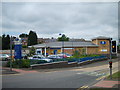
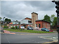
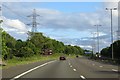
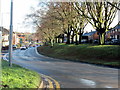

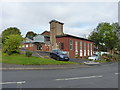
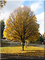
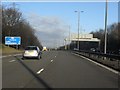
19 photos from this area
Area Information
Key information about the B68 0AQ including its size, population, and administrative classification.
- Area Type
- Postcode
- Area Size
- 8410 m²
- Population
- 1829
- Population Density
- 5910 people/km²
House Prices in B68 0AQ
15
Properties
£207,450
Average Sold Price
£100,000
Lowest Price
£320,000
Highest Price
Showing 15 properties
| Address | Type | Beds | Baths | Last Sale Price | Last Sale Date | |
|---|---|---|---|---|---|---|
| 79 Perry Hill Road, Oldbury, B68 0AQ | Semi-detached | 3 | 1 | £187,000 | Sep 2021 | |
| 93 Perry Hill Road, Oldbury, B68 0AQ | Semi-detached | 3 | 2 | £248,000 | Sep 2019 | |
| 89 Perry Hill Road, Oldbury, B68 0AQ | Bungalow | 2 | 1 | £285,000 | Jul 2018 | |
| 77 Perry Hill Road, Oldbury, B68 0AQ | Semi-detached | 3 | 1 | £170,000 | Mar 2016 | |
| 69 Perry Hill Road, Oldbury, B68 0AQ | Semi-detached | 4 | - | £252,500 | Dec 2015 | |
| 85 Perry Hill Road, Oldbury, B68 0AQ | Detached | 4 | 1 | £234,000 | Dec 2014 | |
| 71 Perry Hill Road, Oldbury, B68 0AQ | house | - | - | £100,000 | Jul 2011 | |
| 87 Perry Hill Road, Oldbury, B68 0AQ | house | - | - | £320,000 | Sep 2010 | |
| 75 Perry Hill Road, Oldbury, B68 0AQ | Semi-detached | - | - | £150,000 | Jul 2007 | |
| 73 Perry Hill Road, Oldbury, B68 0AQ | house | - | - | £128,000 | Oct 2003 |
Page 1 of 2
Energy Efficiency in B68 0AQ
Amenities
Schools
| Rank | School | Type | Entry gender | Ages |
|---|
Explore more schools in this area
Go to Schools tabDemographics
Household Size
Family (3-5 people)
most common
Accommodation Type
Houses
most common
Tenure
71
majority
Ethnic Group
White
most common
Religion
N/A
most common
Household Composition
N/A
most common
Age
47
median
Adults (30-64 years)
most common
Household Deprivation
N/A
with no deprivation
NS-SEC
31
in Lower managerial occupations
Explore more demographic insights in this area
Go to Demographics tabPlanning
Planning Constraints
- Flood RiskPremium
- Ramsar Wetland SitesPremium
- Area of Outstanding Natural BeautyPremium
- Protected Nature ReservePremium
- Protected WoodlandPremium