Area Overview for B63 2RL
Photos of B63 2RL

Area Information
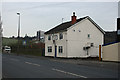
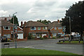
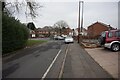
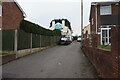
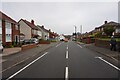
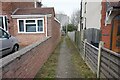
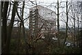
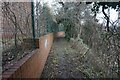
Living in B63 2RL means inhabiting a compact, densely populated postcode area of 1.3 hectares, home to 1,848 residents. Situated near Stourbridge and historically part of the Black Country, this area blends suburban residential zones with pockets of post-WWII development. Cradley and Wollescote, the primary settlements, are bordered by Halesowen to the east and lie three miles from Stourbridge’s town centre. The area’s character is shaped by its compact size and proximity to nearby towns, offering a mix of low-rise housing, former tower blocks, and redeveloped parkland. With a median age of 47, the community skews towards adults aged 30–64, many of whom own their homes. Daily life is defined by proximity to rail and metro stations, local shops, and historical sites like Wollescote Hall. While the area lacks natural constraints such as protected woodlands or AONB designations, its density and connectivity to surrounding towns make it a practical choice for commuters and families seeking a balance between urban and suburban living.
- Area Type
- Postcode
- Area Size
- 1.3 hectares
- Population
- 1848
- Population Density
- 2680 people/km²
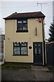
The property market in B63 2RL is dominated by owner-occupied homes, with 57% of residents owning their properties. The area is primarily composed of houses, reflecting a suburban housing stock that includes both private and council-built homes. This mix suggests a focus on family-friendly living, with low-rise developments and former tower blocks indicating a range of property types. The compact nature of the postcode area means the housing stock is limited in scale, with potential for investment in rental properties given the 43% non-owner-occupied segment. Buyers should consider the area’s proximity to Stourbridge and Halesowen, which may influence property values. The prevalence of houses over flats suggests a market skewed towards those seeking larger, more traditional homes, though the smaller footprint of the postcode may limit availability for larger families.
House Prices in B63 2RL
No properties found in this postcode.
Energy Efficiency in B63 2RL
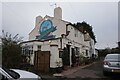
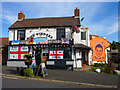
Residents of B63 2RL have access to a range of amenities within practical reach. The retail sector includes major stores like Tesco Lye, Aldi Dudley, and Lidl Cradley, ensuring daily shopping needs are met. Rail and metro stations such as Lye Railway Station and West Bromwich Central provide easy access to nearby towns and cities, while the area’s proximity to Stourbridge and Halesowen adds to its convenience. Historically, the district features sites like Wollescote Hall, a 1508 structure now used by community groups, and Cradley’s old High Street along Colley Lane. Parks and open spaces, including redeveloped areas from former housing estates, offer recreational opportunities. The mix of suburban living and historical landmarks creates a lifestyle that balances practicality with local heritage.
Amenities
Schools
| Rank | School | Type | Entry gender | Ages |
|---|
Explore more schools in this area
Go to Schools tabDemographics
B63 2RL’s population of 1,848 is predominantly composed of adults aged 30–64, with a median age of 47. Home ownership sits at 57%, indicating a mix of owner-occupied properties and rental units. The area is primarily composed of houses, reflecting a traditional suburban layout. The predominant ethnic group is White, though no specific diversity statistics are provided. The high population density of 145,546 people per square kilometre suggests a compact, closely knit community. While deprivation data is not explicitly stated, the area’s amenities and transport links suggest a functional quality of life. The presence of rail and metro stations, combined with nearby retail options, supports daily needs. However, the lack of detailed diversity metrics means the community’s full demographic profile remains partially unexplored.
Household Size
Accommodation Type
Tenure
Ethnic Group
Religion
Household Composition
Age
Household Deprivation
NS-SEC
Explore more demographic insights in this area
Go to Demographics tabPlanning
Planning Constraints
- Flood RiskPremium
- Ramsar Wetland SitesPremium
- Area of Outstanding Natural BeautyPremium
- Protected Nature ReservePremium
- Protected WoodlandPremium